
Length 241 km | ||
 | ||
Highway system National highways of Japan | ||
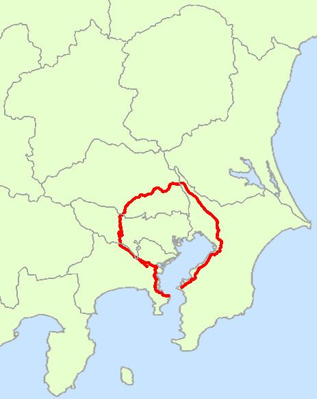
National Route 16 is a national highway in Japan. A beltway around Tokyo, it links the major prefectural capital cities of Yokohama (in Kanagawa Prefecture), Saitama (in Saitama Prefecture), and Chiba (in Chiba Prefecture) as well as Hachiōji (in Tokyo). It also serves Yokosuka and Sagamihara (in Kanagawa Prefecture), Kasukabe (in Saitama Prefecture), and Kisarazu (in Chiba Prefecture). The total length is 241 km.
Contents
Map of Japan, %E5%9B%BD%E9%81%9316%E5%8F%B7%E7%B7%9A
Along with the Ken-Ō Expressway, Route 16 connects the entire length of the Technology Advanced Metropolitan Area (TAMA) Network region - an inland industrial area covering an area of 3000 km2, covering 74 municipalities and home to over 10 million people of whom 4 million work in the TAMA Network firms. In 1998 goods shipped from TAMA had twice the shipment value of the Silicon Valley.