Bridges Y Bridge | ||
 | ||
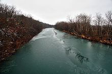
The James River is a 130-mile-long (210 km) river in southern Missouri. Its source is northeast of the town of Seymour in Webster County. Its headwaters initially flow south then turns west to northwesterly north of Seymour and turns southwest near Northview and passes down the east side of Springfield where it is impounded to form Lake Springfield. From Springfield, it flows west and then south past Galena where it enters Table Rock Lake, a reservoir on the White River.
Contents
Map of James River, Missouri, USA
Large sections of the James River are floatable by canoe or kayak. A solid 3-day float from the public access on the downstream side of the dam to Galena is possible when the levels are high enough.
The James River is a drinking water source for the city of Springfield. Springfield Lake is a primary source of water for the cooling system at the James River Power Plant which sits by the dam. James River Freeway on the city's south side is named after the river.
The river's name most likely is a transfer from the James River in Virginia.
