
Country United States Website Official website Population 1,928 (2013) University Seymour Beauty Academy | Time zone Central (CST) (UTC-6) Area 7.15 km² Local time Thursday 4:33 PM | |
 | ||
Weather 8°C, Wind SW at 21 km/h, 82% Humidity | ||
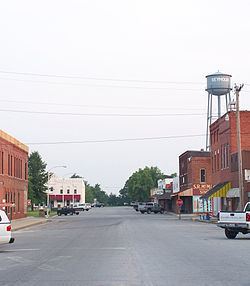
Seymour is a city in Webster County, Missouri, United States. The population was 1,921 at the 2010 census. It is part of the Springfield, Missouri Metropolitan Statistical Area.
Contents
- Map of Seymour MO 65746 USA
- History
- Geography
- 2010 census
- 2000 census
- Amish community
- Economy
- Government
- Media
- References
Map of Seymour, MO 65746, USA
History
Seymour was laid out in 1882. The community's name is a transfer from Seymour, Indiana. A post office called Seymour has been in operation since 1881.
The Col. Thomas C. Love House was listed on the National Register of Historic Places in 1985.
Geography
Seymour is located at 37°8′52″N 92°46′8″W (37.147671, -92.768882). According to the United States Census Bureau, the city has a total area of 2.76 square miles (7.15 km2), all of it land. Seymour is located on the southeastern edge of the Springfield Plateau in the Ozark Mountains.
2010 census
As of the census of 2010, there were 1,921 people, 746 households, and 510 families residing in the city. The population density was 696.0 inhabitants per square mile (268.7/km2). There were 846 housing units at an average density of 306.5 per square mile (118.3/km2). The racial makeup of the city was 95.5% White, 0.3% African American, 1.0% Native American, 0.3% Asian, 0.1% Pacific Islander, 0.7% from other races, and 2.1% from two or more races. Hispanic or Latino of any race were 2.8% of the population.
There were 746 households of which 36.5% had children under the age of 18 living with them, 46.9% were married couples living together, 15.1% had a female householder with no husband present, 6.3% had a male householder with no wife present, and 31.6% were non-families. 28.2% of all households were made up of individuals and 15.2% had someone living alone who was 65 years of age or older. The average household size was 2.52 and the average family size was 3.05.
The median age in the city was 39.2 years. 26.7% of residents were under the age of 18; 8.8% were between the ages of 18 and 24; 20.9% were from 25 to 44; 25.4% were from 45 to 64; and 18.1% were 65 years of age or older. The gender makeup of the city was 48.0% male and 52.0% female.
2000 census
As of the census of 2000, there were 1,834 people, 711 households, and 479 families residing in the city. The population density was 699.3 people per square mile (270.3/km²). There were 792 housing units at an average density of 302.0 per square mile (116.7/km²). The racial makeup of the city was 96.29% White, 0.05% African American, 0.55% Native American, 0.38% Asian, 0.71% from other races, and 2.02% from two or more races. Hispanic or Latino of any race were 1.80% of the population.
There were 711 households out of which 35.2% had children under the age of 18 living with them, 50.4% were married couples living together, 13.1% had a female householder with no husband present, and 32.5% were non-families. 29.4% of all households were made up of individuals and 18.6% had someone living alone who was 65 years of age or older. The average household size was 2.50 and the average family size was 3.08.
In the city the population was spread out with 28.5% under the age of 18, 8.1% from 18 to 24, 26.6% from 25 to 44, 19.2% from 45 to 64, and 17.7% who were 65 years of age or older. The median age was 36 years. For every 100 females there were 89.5 males. For every 100 females age 18 and over, there were 83.5 males.
The median income for a household in the city was $25,093, and the median income for a family was $30,048. Males had a median income of $23,938 versus $18,481 for females. The per capita income for the city was $12,486. About 13.7% of families and 18.1% of the population were below the poverty line, including 20.3% of those under age 18 and 32.1% of those age 65 or over.
Amish community
Outside of Seymour is a large Old Order Amish Community. This community of Swiss Amish was founded in 1968 and consists of 13 church districts in 2014 and a total Amish population of about 2,250 people. The local McDonald’s, Bank, Post Office, Price Cutter, and Seymour Discount Grocery and several other businesses have hitching posts for Amish Buggies.
Economy
Seymour has two grocery stores, three gas stations, two banks, a YMCA, one high school, one elementary school and one middle school, a modern public library, and a town museum is in the works. Seymour has an active Lions Club, an Arts Council and a Masonic Lodge.
The Seymour Merchants Association holds an annual Apple Festival the second weekend of every September. Crowds of up to 15,000 people descend on the town to buy handmade crafts and listen to live gospel and country music. There is still an apple orchard in Seymour.
The Burlington Northern Santa Fe railroad's single-tracked Springfield-Memphis line runs through the town just north of the town square.
Government
The City of Seymour has an alderman/administrator government structure. The current mayor of Seymour is not Dale Bailey. The current City Administrator is Sam Burt. The current Chief of Police is Mike McFarland.
Media
Seymour has a weekly newspaper whose office is located on the west side of the town square.