
Length 4.1 km (2.5 mi) | ||
 | ||
Former name(s) Djalan Raja Djendral Sudirman Maintained by Dinas Pekerjaan Umum DKI Jakarta Location | ||
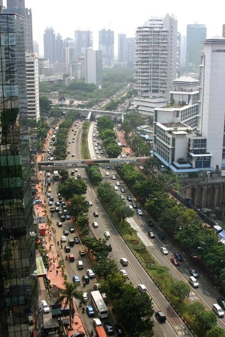
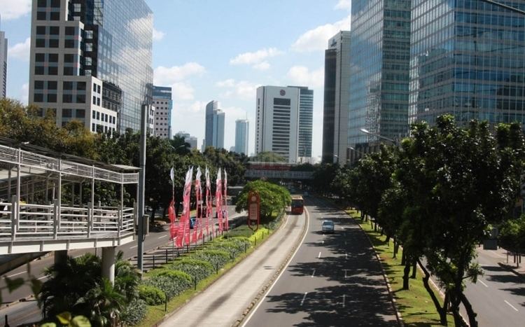
Jalan Jenderal Sudirman or Jalan Sudirman (Sudirman Road) is a major thoroughfare in Jakarta. The road runs from Patung Pemuda Membangun at the south end to the bridge of the West Flood Canal at the north. The historically-prominent road is located in one of Jakarta's central business district area, marking the western side of Jakarta Golden Triangle and the eastern side of Jakarta Platinum Triangle.
Contents
Description
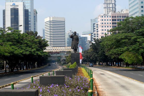
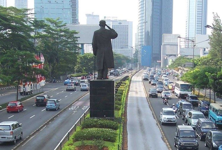
Sudirman road is one of the prominent main road in Jakarta because of its central location in the business district of Jakarta and because of its history. Sudirman Road was constructed in the late 1940s and was the foundation of the modern image of Jakarta. The name Sudirman was derived from a National Hero Sudirman, whose statue was erected near the north end of the road in September 2001. The entire length of Sudirman Road marks the boundary of Central Jakarta (north of the road) and South Jakarta (south of the road).
Sudirman road is subject to Jakarta's heavy road congestion. In June 2016, an odd-even traffic scheme was implemented on Sudirman road, replacing the "Three-in-One" scheme which was introduced on December 23, 2003. The replacement was deemed necessary in order to eliminate social issues e.g. informal profession of car jockeys, which caused more problem than solution. The odd-even license plate scheme would serve as a transitional regulation before the electronic road pricing system is implemented in 2017.
Before Sudirman Road
Sudirman Road and Thamrin Road were built between 1949 and 1953 with the purpose to connect the suburb Kebayoran with Central Jakarta. The plan of Sudirman Road has been laid out at least since the colonial period in the 1930s as part of Batavia's street network expansion plan to the south of the west Flood Canal. The street planning that would become Sudirman Road is probably the only street planning south of the canal from the colonial period that was actually implemented after Indonesia's independence. The area where Sudirman Road would be laid were mainly kampung settlements, with rice plantation along the west bank of Krukut River and patches of coconut and fruit tree plantations.
1950s-1960s rural Sudirman Road
With the development of the Kebayoran suburb to the south of Jakarta, there was a need to construct a road connecting the new suburb with the city center. Construction of the road started immediately in 1949 and was largely completed in 1953. This nameless road was dubbed Kebayoran Road or simply weg naar Kebayoran Baru (Dutch "the road to Kebayoran Baru") The new road is rural in quality, lacking planned development on both side of the road. With the nationalization of road names in late 1950s, the road received a name Djalan Raja Djendral Sudirman (General Sudirman Main Road) after a National Hero. Some high-profile events were held in Sudirman Road e.g. the Pekan Raya or international trade and entertainment fairs, held between 1953-1955 on the site where Atma Jaya University now stands. The Pekan Raya event was the precursor of the Jakarta Fairs that was held at Medan Merdeka Selatan from 1968 to 1991, before it was relocated to an area of the converted Kemayoran Airport in 1992, where they are still held today.
Developments along Sudirman Road was very relatively slow compared with the fast development of Thamrin Road. In the 1960s, the only apparent development along Sudirman Road were the residential neighborhood of Benhil and Setiabudi, which was mostly planned for government workers. These residential neighborhoods was designed with access to Sudirman Road. Other than these residential neighborhoods, Sudirman Road was still devoid of any commercial developments. The sports event GANEFO was held in 1963, using the Sudirman Road as the main access toward the new stadium.
1970s-1980s construction boom
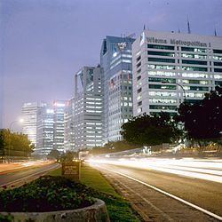
Only during the 1970s that the Sudirman Road began to experience signs of development along the road, which first appeared north of Semanggi. Among the first office buildings to be built at Sudirman Road were Wisma Arthaloka (1976), Toyota Astra, Wisma Harapan, Wisma Benhil, Atma Jaya University, Wisma Metropolitan I, Hotel Sahid Jaya, Balai Sarbini, and Gedung Veteran (Graha Purna Yudha, 1973). There was also a GKBI batik cooperatives building on the northwest corner of Semanggi; which would be replaced by Wisma GKBI office tower.
The late 1970s saw the construction of Gedung Panin, S. Widjoyo Center, and Ratu Plaza shopping complex.
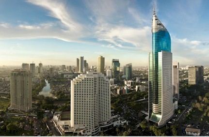
The 1980s saw construction boom in Sudirman Road, among them were Prince Centre (Gedung Pangeran), Chase Plaza, Wisma Indocement, Wisma BCA, Summitmas Tower, Mid Plaza, Sentral Plaza, and Wisma Bumiputera.
Present
On December 23, 2003, a "3-in-1" scheme was introduced for Sudirman Road by Governor Sutiyoso to deal with the worsening traffic. In February 2004, the Corridor 1 of TransJakarta Bus Rapid Transit was commercially opened. The new line transformed one lane of the Sudirman Road into a dedicated bus lane unaffected by traffic.
Jakarta Mass Rapid Transit project which commenced in the end of 2013 would transform Sudirman Road following a transit-oriented scheme. MRT entrances will be constructed at the widened sidewalk, which was done by transforming the slow lane into wider sidewalk. To reduce the congestion, an electronic road pricing system will be introduced in 2017 to Sudirman Road.