
Basin size 368 km (142 sq mi) Discharge 15 m³/s | River system Jōganji River Length 56 km Basin area 368 km² | |
 | ||
Main source Mount Kitanomata2,661 m (8,730 ft) | ||
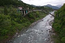
The Jōganji River (常願寺川, Jōganji-gawa) is a river in Toyama Prefecture, Japan, that flows through the city of Toyama as well as the town of Tateyama. The river was previously referred to as the Nii River (新川 Nii-kawa).
Contents
Map of Joganji River, Arimine, Toyama, Toyama Prefecture, Japan
Route
The river originates in the Tateyama Mountains in the south-eastern area of the city of Toyama. From there, it flows north-west, helping form the border between Toyama and Tateyama. It then cuts through Toyama before emptying into Toyama Bay.
References
Jōganji River Wikipedia(Text) CC BY-SA