
Country Japan Prefecture Kumamoto Prefecture Website www.vill.itsuki.lg.jp Population 1,388 (2006) Flower Camellia | Region Kyushu District Kuma Area 252.9 km² Local time Friday 11:11 AM | |
 | ||
Time zone Japan Standard Time (UTC+9) Weather 12°C, Wind NW at 11 km/h, 44% Humidity | ||
Itsuki (五木村, Itsuki-mura) is a village located in Kuma District, Kumamoto Prefecture, Japan.
Contents
Map of Itsuki, Kuma District, Kumamoto Prefecture, Japan
In 2006 the village had an estimated population of 1,388 and a density of 5.66 persons per km2. The total area is 252.94 km2.
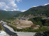
The village is located in the southeast of Kumamoto and the north of the regional center Hitoyoshi. It is very mountainous and most villagers live in narrow valleys eroded by Kawabe River and others.
The name of Itsuki is well known for an indigenous folksong Itsuki no Komoriuta, or Lullaby of Itsuki.
The plan for constructing Kawabe River Dam was accepted by the village after a long dispute among villagers and environmentalists.
Kawabe River Dam
This project has been put on hold by the Japanese government until further notice.
References
Itsuki, Kumamoto Wikipedia(Text) CC BY-SA