
Type Highway | Length 166 km Via Childers, Biggenden | |
 | ||
SW end Burnett Highway, Ban Ban Springs, Queensland | ||
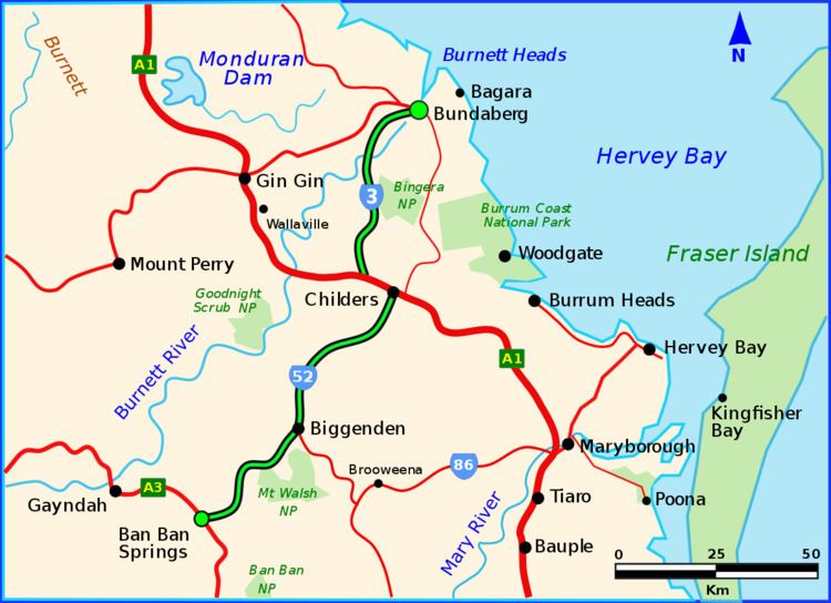
The Isis Highway is a state highway in southern Queensland, Australia. The highway is relatively short, and runs for 135 kilometres (84 mi) in a north-east / south-west direction between the Burnett Highway at Ban Ban Springs and Bundaberg. The Isis Highway links the cattle farming districts of the North Burnett with the sugar producing Bundaberg and Fraser Coast region.
Contents
Map of Isis Hwy, Queensland, Australia
The highway takes its name from the Isis River, which flows between Maryborough and Childers. The highway also passes through a significant amount of the former Isis Shire local government area, of which Childers was the administrative centre.
The Isis Highway is signed as State Route 52 between Ban Ban Springs and Childers, and State Route 3 between Childers and Bundaberg.
Principal towns along the Isis Highway
References
Isis Highway Wikipedia(Text) CC BY-SA