
Country United States County Cayuga FIPS code 36-37660 Elevation 139 m Local time Wednesday 2:52 AM | State New York Time zone Eastern (EST) (UTC-5) GNIS feature ID 0979094 Population 2,206 (2010) | |
 | ||
Weather -9°C, Wind NW at 24 km/h, 84% Humidity Area 90.39 km² (90.13 km² Land / 26 ha Water) | ||
Ira is a town in Cayuga County, New York, United States. The population was 2,206 at the 2010 census. The town is in the northern part of the county and is northwest of Syracuse.
Contents
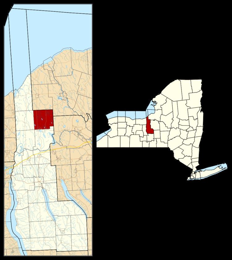
Map of Ira, NY, USA
History
Ira was part of the Central New York Military Tract. The first settlers arrived around 1800. The town was founded in 1821 from part of the town of Cato. Part of Ira was returned to Cato in 1824.
Geography
According to the United States Census Bureau, the town has a total area of 34.9 square miles (90.4 km2), of which 34.8 square miles (90.1 km2) is land and 0.12 square miles (0.3 km2), or 0.30%, is water. Many drumlins, relics of the Ice Age, are scattered about the town.
The north town line and part of the east town line are the border of Oswego County, and the remainder of the east town line is the border of Onondaga County.
New York State Route 34 and New York State Route 176 are north-south highways in Ira. New York State Route 370 is an east-west highway along the south town line.
As of the census of 2000, there were 2,426 people, 822 households, and 669 families residing in the town. The population density was 69.6 people per square mile (26.9/km²). There were 867 housing units at an average density of 24.9 per square mile (9.6/km²). The racial makeup of the town was 97.03% White, 0.41% African American, 0.70% Native American, 0.04% Asian, 0.04% Pacific Islander, and 1.77% from two or more races. Hispanic or Latino of any race were 1.03% of the population.
There were 822 households out of which 41.4% had children under the age of 18 living with them, 65.5% were married couples living together, 10.7% had a female householder with no husband present, and 18.5% were non-families. 14.1% of all households were made up of individuals and 4.1% had someone living alone who was 65 years of age or older. The average household size was 2.95 and the average family size was 3.20.
In the town, the population was spread out with 30.6% under the age of 18, 7.1% from 18 to 24, 31.7% from 25 to 44, 22.0% from 45 to 64, and 8.5% who were 65 years of age or older. The median age was 35 years. For every 100 females there were 100.8 males. For every 100 females age 18 and over, there were 100.1 males.
The median income for a household in the town was $46,027, and the median income for a family was $48,750. Males had a median income of $35,472 versus $25,134 for females. The per capita income for the town was $16,954. About 3.4% of families and 7.0% of the population were below the poverty line, including 9.0% of those under age 18 and 5.3% of those age 65 or over.