
Country United States County Doniphan Area code(s) 785 Elevation 262 m | State Kansas Time zone Central (CST) (UTC-6) GNIS feature ID 472808 Local time Tuesday 11:43 PM | |
 | ||
Weather -6°C, Wind NE at 11 km/h, 63% Humidity | ||
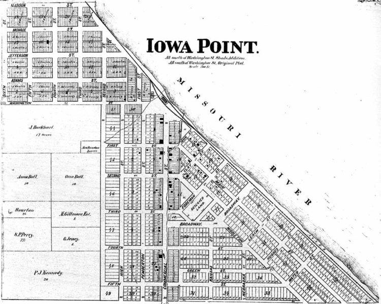
Iowa Point is an unincorporated community in northeastern Doniphan County, Kansas, United States. It is included in the St. Joseph, Missouri Metropolitan Area.
Contents
Map of Iowa Point, Iowa, KS 66035, USA
History
Iowa Point was first settled in 1854 on land received from the U.S. Government in payment for missionary services done at the nearby Iowa, Sac and Fox Indian mission. The town was a major shipping point between Leavenworth and Omaha and by 1857, the town had a population estimated at 3,000 making it the second largest town on the Missouri River next to Leavenworth.
The town divided on the issue of slavery; by the end of the Civil War, it had nearly been completely burned, and businesses had nearly been depleted. The town never recovered.
The first post office in Iowa Point opened in 1855, closed temporarily in 1914, reopened that same year, and closed permanently in 1933.