
Vehicle registration IL Elevation 616 m Population 3,434 (1 Apr 2009) Postal code 6401 | Time zone CET (UTC+1) Website www.inzing.tirol.gv.at Area 19.37 km² Local time Wednesday 2:14 AM Area code 05238 | |
 | ||
Weather 2°C, Wind NW at 3 km/h, 76% Humidity | ||
Contition
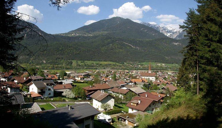
Inzing is located in the Inntal between Innsbruck in east and Telfs in west. It lies on the southern bank of the Inn River. In the south of the town you see the Rangger Köpfl, in the north the Zirler Berg.
Neighbour municipalities
Flaurling, Gries im Sellrain, Hatting, Oberperfuss, Pettnau, Ranggen, Sankt Sigmund im Sellrain, Sellrain, Zirl.
History
The first time inzing was mentioned in a document was 1034. The district Hatting was attached 1974 to Inzing and 1993 as an own commune reconstituted.
Economy
The industrial district, which is located at the east of the village, includes timber processing.
Personalities
References
Inzing Wikipedia(Text) CC BY-SA