
Existed: 1970 – present Length 97.95 km | Counties: Duval Constructed 1970 | |
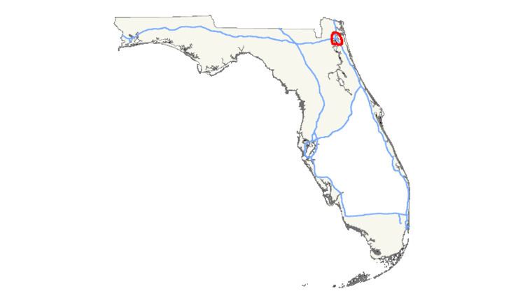 | ||
Interstate 295 (I-295), an auxiliary route of Interstate 95, is a beltway around central Jacksonville, Florida. The 60.864 miles (97.951 km)-long beltway consists of two segments, the West Beltway (formerly signed as simply I-295), and the East Beltway (formerly signed as State Road 9A), with I-95 serving as the dividing line between the two. The entire highway carries a hidden designation as State Road 9A by the Florida Department of Transportation. The West Beltway was constructed in the 1970s, with the East Beltway being built from the 1980s-2000s.
Contents
Map of I-295, Jacksonville, FL, USA
Route description
Beginning at the I-95 interchange in southeastern Duval as the West Beltway, the beltway travels west, passes through the Mandarin area with interchanges at Old St. Augustine Road, and SR 13 (San Jose Boulevard). It then travels along the three mile Buckman Bridge crossing the St. Johns River immediately south of Naval Air Station Jacksonville, and serves as a major connection in the southern part of Jacksonville. At the western end of the river, I-295 continues west, serving as the border between Clay County and Duval County running just north of the town of Orange Park with interchanges at US 17/SR 15 (Roosevelt Boulevard) and SR 21 (Blanding Boulevard), serving Naval Air Station Jacksonville and Clay county. Before turning north through the Westside of Duval county, the freeway also has a full interchange at east-west connector Collins Road to serve the Argyle and Oak Leaf areas in addition to NASJAX. Continuing north, with full interchanges at SR 134 (103rd Street), SR 208 (Wilson Boulevard), and SR 228 (Normandy Boulevard) Interstate 295, the west half of Jacksonville's Beltway reaches its interchange with Interstate 10 approximately six miles west of Downtown, then crosses over Beaver Street (US 90), a railroad, creek, then continues into Northern Duval.
North of the I-10 interchange, the western beltway loops around the northwest side of Jacksonville with full interchanges located at both Commonwealth Avenue and Pritchard Road, before curving northeast to an interchange at US 1/US 23. The road then crosses the Trout River before crossing SR 104 (Dunn Avenue), where this northern portion of the loop turns east, with interchanges at SR 115, SR 243 (International Airport Boulevard) / Duval Road, and I-95, all just south of the Jacksonville International Airport, where the East Beltway begins.
East of the I-95 interchange near the airport, I-295 continues east as the East Beltway, with the next interchange being US 17. I-295 starts to curve to the southeast, with interchanges at Pulaski Road, and Alta Drive/Yellowbluff Road. Before orienting itself southward at the SR 105 (Zoo Parkway/Heckscher Drive) area, the freeway crosses the Dames Point Bridge over the St. Johns River into the Fort Caroline area. Just south of the bridge, a partial interchange with SR 113 (Southside Connector) in the Regency area is followed by full interchanges with Merrill Road and Monument Road, providing access through Arlington between Jacksonville University and NS Mayport. Continuing south, it has full interchanges with SR 10 (Atlantic Boulevard), St. Johns Bluff Road, US 90/SR 212 (Beach Boulevard) and Town Center Parkway/University of North Florida Drive. The next interchange, J. Turner Butler Boulevard is a freeway to freeway interchange, finished in 2008. After interchanges with Gate Parkway and SR 152 (Baymeadows Road) and a partial interchange with SR 9B, I-295 curves to the west, it crosses US 1 before completing the loop at I-95 in south Jacksonville.
History
The current version of I-295 appeared on maps in 1967, as a loop around central Jacksonville, with the first section between I-95 in south Duval County to SR 134 (exit 16) in 1970, and the section from SR 134 to I-10 opened in 1973. The section from I-10 to Commonwealth Ave. (exit 22) opened in 1975, followed by the extension to I-95 in north Jacksonville in 1977, completing the western section of the loop.
The eastern section, formerly signed as SR 9A, had its first section open from I-95 in north Jacksonville to US 17 (exit 36) in 1983. The eastern half of the loop was constructed initially as a Super 2 highway with traffic lights in the late 1980s, and was not up to interstate standards. The Dames Point Bridge was signed as I-295 in 1990, but this designation was removed in 1993 and replaced by SR 9A. The final sections of SR 9A were completed in 2006, creating a complete loop around central Jacksonville. Several sections not under interstate compliance were upgraded, and the route was considered interstate ready in 2009.
The I-295 East Beltway (formerly signed as SR 9A) was designated the Ronald Reagan Memorial Highway in a Florida Department of Transportation ceremony on August 27, 2009. After the Federal Highway Administration accepted the road as the eastern loop of Interstate 295 in 2010, the state was no longer able to name the highway.
Improvements to the I-95 interchange north close by the airport were under construction, new lanes and a flyover ramp were constructed to help improve the interchange. This was completed in late September 2010.
On December 4, 2011, the two halves of the Jacksonville beltway changed over to their current designations, the West Beltway (formerly the whole of I-295), and the East Beltway (formerly State Road 9A). The East Beltway was officially given the I-295 designation, making the entire beltway I-295, with State Road 9A remaining the hidden designation for the entire beltway for FDOT purposes.
In February 2011, construction began for a new interchange at Collins Road, just west of the congested Blanding Boulevard exit. The $63.4 million project was completed in December 2013, earlier than the originally projected 2014 date.
1992 attacks
In 1992, a series of sniper shootings and concrete block- and brick-throwing attacks occurred on the West Beltway. Of the 36 confirmed attacks, "5 [were] shootings from moving vehicles, 15 shootings from overpasses or the side of the road, 15 cases in which concrete, bricks or rocks were thrown at vehicles and 1 instance in which shooting and concrete-throwing were combined." At least one motorist, William Klinedinst, died after a concrete block landed on the hood of his moving car, causing it to crash; his body was not identified for several weeks. Another motorist, Debra Lewis, received a bullet wound to the face, and several other injuries occurred. The incidents spurred then-governor Lawton Chiles to dispatch the Florida National Guard to patrol the roadway and the American Automobile Association (AAA) to issue a rare travel warning for the interstate and direct its customers to avoid its use. A task force was set up by the Jacksonville Sheriff's Office (JSO) to investigate the incidents and, though charges were filed, they were eventually dropped. The task force was disbanded at the end of 1992 and the incidents remained unsolved to this day.
Future
Extending from the southeast corner of the loop is the future Interstate 795, an approximately 11-mile (18 km) expressway currently signed as State Road 9B. In May 2008, the SR 9B project was suspended by the Florida Department of Transportation. The project was reinstated in 2009, and construction of phase one began in June 2010 and opened on September 19, 2013. Construction of phase two, which extends SR 9B from US 1 to I-95, started in May 2013 and opened on June 13, 2016, as SR 9B was renamed Interstate 795. Construction of phase three extending south of I-95 to County Road 2209 and Race Track Road via a connector road in St. Johns County began in August 2015 and is scheduled for completion in 2018.
Exit list
The entire route is in Jacksonville, Duval County.