
Total length 4,968 m Opened 1 May 1970 | Construction started 1964 Clearance below 20 m | |
 | ||
ID number 720249 southbound720343 northbound Bridge type Beam bridge, Girder bridge Similar Fuller Warren Bridge, St Johns River, Acosta Bridge, Dames Point Bridge, Hart Bridge | ||
Buckman bridge
The Henry Holland Buckman Bridge carries I-295 West Beltway traffic over the St. Johns River in Jacksonville, Florida. It was named for Henry Holland Buckman, a prominent legislator and attorney who was instrumental in establishing the Florida state road system.
Contents
History
Prior to 1970, travel across the St. Johns River from Orange Park to Mandarin was a journey. One route involved driving north to downtown Jacksonville, crossing the Fuller Warren Bridge, then driving south, a distance of nearly 30 miles and an hour of travel time. The alternative was to drive south to Green Cove Springs and across the wooden planks of the Shands Bridge, almost twice the distance of the northern route.
The first public hearing was held in July, 1963 and after intense discussion regarding the placement of the structure, the decision was made in April, 1964 to place the bridge in Duval County, just north of the Clay County line. Construction began, but the first concrete pilings exploded days after they were poured. Investigation revealed that the heat generated from the curing concrete increased Anaerobic digestion by bacteria in the brackish water and generated methane gas. The engineers were forced to change their construction method.
Details
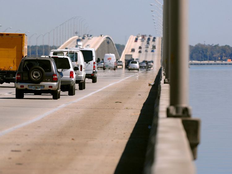
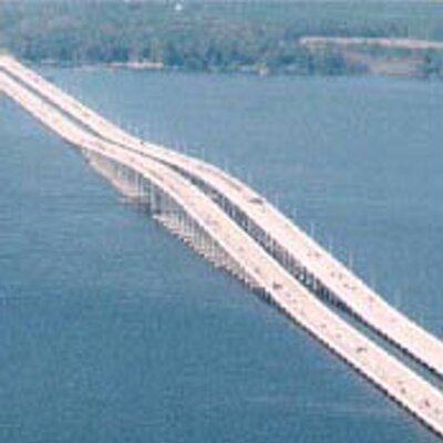
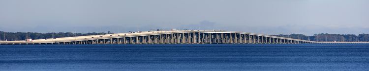
The bridge is of beam-type construction, approximately 3.1 miles (5 km) in length, and travels roughly east-west. The eastbound (carrying I-295 South traffic) and westbound (carrying I-295 North traffic) lanes are built on separate bridge structures. Average daily traffic in 1996 was estimated at 78,000 vehicles. In 1995, the bridge was expanded from two lanes in each direction with partial breakdown lanes to four lanes in each direction with full breakdown lanes. A Florida Department of Transportation study in September, 1997 counted 110,743 vehicles. With busy exits within a half mile of either end of the bridge, rush-hour backups are typical. Downtown Jacksonville and Naval Air Station Jacksonville are visible from the bridge to the north. On a clear day, the Seminole Electric power plant in Palatka can be seen to the south of the bridge.
Closings
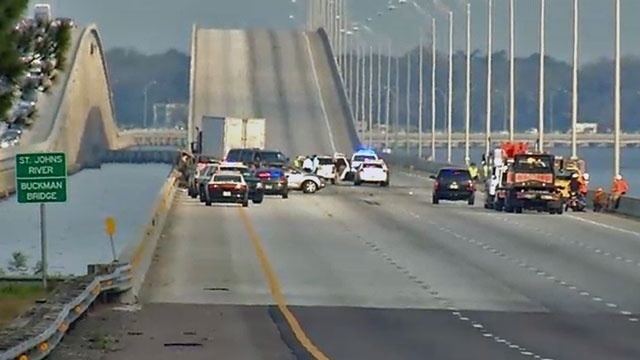
While rarely closed for weather, two situations have made shutdown necessary: Tropical Storm Fay and prolonged freezing conditions. During tropical storms or hurricanes, sustained winds of over 40 miles per hour are considered hazardous and warrant closure. On December 23, 1989 the temperature dropped to 26° and precipitation changed from rain to sleet to snow, which lasted for several days. All the bridges in Jacksonville were impassable and closed for more than 24 hours, except for the original St. Elmo W. Acosta Bridge, which was first opened to traffic in 1921.