
North end: I-880 in San Leandro Length 3.421 km | Counties: Alameda | |
 | ||
Existed: May 1983 by FHWA – present South end: I-580 / SR 238 in Castro Valley County Alameda County, California | ||
Interstate 238 (I-238) is a short auxiliary route of the Interstate Highway System in the San Francisco Bay Area in the U.S. state of California. It comprises the northernmost 2.126 miles of Route 238, as defined by the California Streets and Highways Code. Originally signed as State Route 238 (SR 238) until 1983, it connects I-580 in Castro Valley (where SR 238 continues south) with I-880 in San Leandro.
Contents
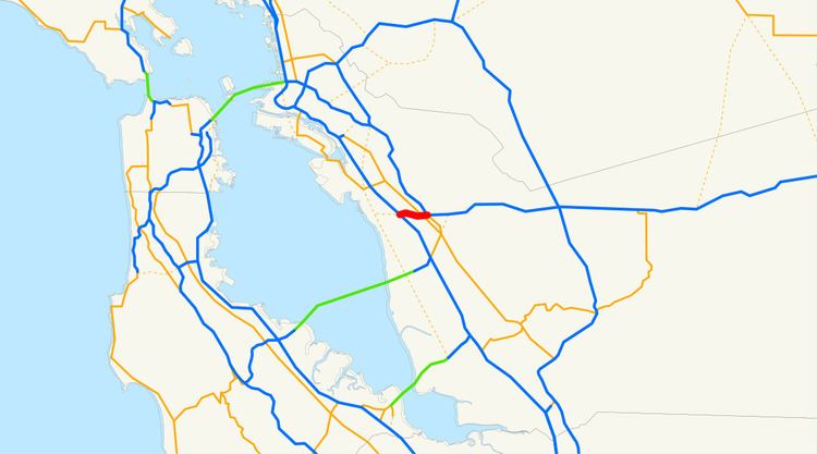
Map of I-238, California, USA
This route is part of the California Freeway and Expressway System.
Route description
Although the 2.16-mile-long (3.48 km) I-238 goes in an east–west direction from Castro Valley to San Leandro, Caltrans officially signs it as a north–south freeway since the rest of SR 238 is more north–south. The south (or east) terminus of I-238 is at its interchange with I-580 and SR 238 in Castro Valley. From there, it enters into the southern portion of the census-designated place of Ashland, running parallel to its border with Cherryland. Then after entering San Leandro, I-238 terminates at I-880.
I-238 and I-880 are used as an alternate truck route between Castro Valley and Oakland; trucks over 4.5 short tons (4.1 t) are prohibited through the latter on I-580.
Numbering
The number does not follow established rules for numbering Interstates, as there is no I-38. As it connects two auxiliary routes of I-80, it would normally use a three-digit number ending in 80, but of the nine possible numbers, two (180 and 480) were in use by State Routes (the latter an Interstate until 1968), and the remainder were already in use by other California auxiliary routes. (I-880 was designated at the same time as I-238.)
History
The section of road that is now I-238 had no signed number before the 1964 renumbering; it was pre-1964 Legislative Route 228 (along with an unbuilt extension west to unbuilt SR 61, which is still included in the SR 238 definition).
The segment from what is now I-580 to I-880 was built as a freeway in 1956. The rest of SR 238 south to I-680 in Fremont was also planned to be upgraded to a freeway (parallel to present I-880), but after it was unsuccessfully submitted to the Interstate Highway System in October 1968, and after several lawsuits, it never got off the ground.
When present, I-880 was added to the Interstate Highway System as a renumbering of part of SR 17, the short piece of SR 238 connecting I-880 to I-580 was also added; both were non-chargeable routes (not eligible for Interstate Completion funds). Both numbers—I-238 and I-880—were approved by the American Association of State Highway and Transportation Officials (AASHTO) on July 7, 1983. The interchanges with I-580 and I-880 were rebuilt from 1988 to 1994, in part to add missing ramps between I-238 and I-880 towards the south. Prior to the completion of the ramps, access was provided by Hesperian Boulevard.
On July 7, 1983, while approving the designation, AASHTO said:
This is to inform you that your application for the elimination of Route 180 and extension of Route 580, and the establishment of Route 880 and Route 238 have been approved.
On July 27, 1983, Caltrans responded:
We already have a State Route 180 in our Fresno area, and this route is separated from I-580 in Castro Valley by about 100 miles [160 km]. We are therefore unable to recommend the designation of existing I-580 between Castro Valley and Oakland as I-180.
With the decommissioning of SR 480 in 1991, the "480" designation was once again made available. However, there has been no push since then to renumber I-238 to I-480.
In September 2006, a project began to reconstruct the entire length of I-238, including a reconfigured interchange with I-880 and an added travel lane in each direction. Additionally, almost all of the bridges and overpasses were replaced with new ones meeting current earthquake resistance standards. The project was completed in October 2009, six months ahead of schedule.
Exit list
Except where prefixed with a letter, postmiles were measured on the road as it was in 1964, based on the rest of SR 238, and do not necessarily reflect current mileage. R reflects a realignment in the route since then, M indicates a second realignment, L refers an overlap due to a correction or change, and T indicates postmiles classified as temporary (for a full list of prefixes, see the list of postmile definitions). Segments that remain unconstructed or have been relinquished to local control may be omitted. The entire route is in Alameda County.