
Country United States County Worcester Incorporated 1653 Elevation 91 m Population 8,055 (2010) | Settled 1643 Time zone Eastern (UTC-5) Zip code 01523 | |
 | ||
Weather -12°C, Wind NW at 23 km/h, 38% Humidity | ||
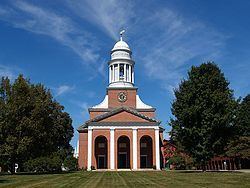
Luther burbank s birthplace lancaster massachusetts
Lancaster is a town in Worcester County, Massachusetts, in the United States. Incorporated in 1653, Lancaster is the oldest town in Worcester County. As of the 2010 census, the town population was 8,055.
Contents
- Luther burbank s birthplace lancaster massachusetts
- Map of Lancaster MA USA
- History
- Geography
- Demographics
- Education
- Library
- Notable people
- References
Map of Lancaster, MA, USA
Lancaster is home to many great wilderness recreation areas with its hills, rivers, lakes, and forests.
For geographic and demographic information on the village of South Lancaster, please see the article South Lancaster, Massachusetts.
History
Lancaster was first settled as "Nashaway" (after the local Nashaway Indian tribe) in 1643. It was officially incorporated and renamed "Lancaster on the Nashua" in 1653. Until it was cut down in 1989 due to safety concerns, Lancaster boasted the largest oak tree in the state, called the Beaman Oak, named after settler Gamaliel Beaman (1623–1677).
Lancaster boasts being the official "mothertown" to all of central Massachusetts. Towns such as Harvard, Bolton, Leominster, Clinton, Berlin, Sterling, and part of West Boyslton were all once considered part of Lancaster.
Supporters of Lancaster's founder, John Prescott (1604–1681), wished to name the new settlement Prescottville, but the Massachusetts General Court considered such a request from a common freeman presumptuous, given that at that time, not even a governor had held the honor of naming a town after himself. Instead, they decided to use Lancaster, the name of his home town in England.
Lancaster was the site of the Mary Rowlandson (c. 1637–1711) attack in February 1676 (1675 old style calendar). During King Philip's War, which was fought partially in Lancaster, a tribe of Indians pillaged the entire town of Lancaster. Their last stop on their trail of destruction was Mary Rowlandson's house. Coming to the defense of the house was Rowlandson's brother-in-law, who was immediately shot and killed by the attacking Indians. The Indians then set fire to the house, forcing Rowlandson to exit the burning building. Upon crossing the doorstep, Rowlandson saw a scene full of carnage. The majority of her household was slaughtered, with the exception of her husband, Joseph Rowlandson Sr., who was not on the premises, their son, also called Joseph, their two daughters, Mary and Sarah, and herself. Mary, her son, and her two daughters were captured by the Indians and forced to join their travels across New England. The Indians non-fatally shot Mary Rowlandson in her side, but her youngest daughter, Sarah, sustained an injury during the attack that would later bring about her death.
After her release from captivity, Rowlandson wrote a book called A Narrative of the Captivity and Restoration of Mrs. Mary Rowlandson. The book is widely considered one of the greatest examples of a captivity narrative. In 2000, Lancaster Elementary School changed its name to Mary Rowlandson Elementary School.
Geography
According to the United States Census Bureau, the town has a total area of 28.2 square miles (73 km2), of which 27.7 square miles (72 km2) is land and 0.5 square miles (1.3 km2), or 1.84%, is water.
Lancaster is bordered by Lunenburg and Shirley to the north, Harvard to the northeast, Bolton to the southeast, Clinton to the south, Sterling to the southwest, and Leominster to the northwest.
Demographics
As of the census of 2000, there were 7,380 people, 2,049 households, and 1,551 families residing in the town. The population density was 266.7 people per square mile (102.9/km²). There were 2,141 housing units at an average density of 77.4 per square mile (29.9/km²). The racial makeup of the town was 84.51% White, 10.61% African American, 0.19% Native American, 1.15% Asian, 1.54% from other races, and 1.99% from two or more races. Hispanic or Latino of any race were 7.44% of the population.
There were 2,049 households out of which 36.4% had children under the age of 18 living with them, 64.1% were married couples living together, 8.2% had a female householder with no husband present, and 24.3% were non-families. Of all households 19.1% were made up of individuals and 8.0% had someone living alone who was 65 years of age or older. The average household size was 2.80 and the average family size was 3.22.
In the town, the population was spread out with 21.7% under the age of 18, 11.1% from 18 to 24, 35.4% from 25 to 44, 21.8% from 45 to 64, and 9.9% who were 65 years of age or older. The median age was 36 years. For every 100 females there were 125.8 males. For every 100 females age 18 and over, there were 129.3 males.
The median income for a household in the town was $60,752, and the median income for a family was $66,490. Males had a median income of $42,367 versus $35,417 for females. The per capita income for the town was $21,010. About 4.4% of families and 4.1% of the population were below the poverty line, including 1.5% of those under age 18 and 14.0% of those age 65 or over.
Education
Lancaster is served by the Nashoba Regional School District. It is also the site of Atlantic Union College and of South Lancaster Academy, incorporated in 1882–1883. The Dr. Franklin Perkins School is a private special education school located in the town. Trivium School, founded in 1979, is a private Catholic college preparatory school occupying the former estate of E. V. R. Thayer, Jr.
Library
Lancaster's public Thayer Memorial Library first opened in 1868. In fiscal year 2008, the town of Lancaster spent 1.74% ($259,465) of its budget on its public library—some $36 per person.