
Length 124 km | ||
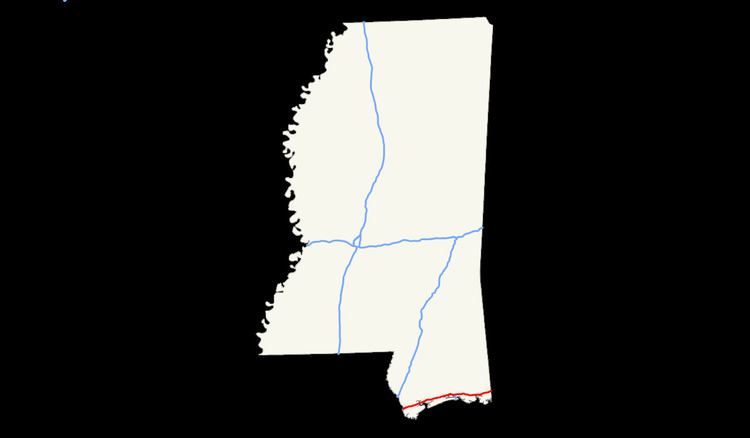 | ||
East end: I‑10 at Alabama state line | ||
Interstate 10, a major east–west Interstate Highway in the southern areas of the United States, has a section of about 77 miles (124 km) in Mississippi.
Contents
Route description
Interstate 10 enters the Gulf Coast area of Mississippi from Louisiana after crossing the East Pearl River. The highway parallels U.S. Route 90 to the north as it runs through the southern parts of the three southernmost counties in the state: Hancock, Harrison and Jackson.
The highway passes through the northern sections of the cities of : Gulfport, Biloxi, and Moss Point.
After leaving Moss Point, I-10 heads northeastward and enters Alabama after trekking 77 miles (124 km) in the Magnolia State. Interstate 10 contains three lanes from Bay St. Louis, Mississippi to Ocean Springs, Mississippi in both directions.
History of Interstate 10 in Mississippi
Interstate 10 was built in 1982 throughout Mississippi. Interstate 10 originally was completed in Alabama and Louisiana before Mississippi completed it's portion. I-10 in Alabama would default on to U.S 90 at the state line which in Mississippi before I-10 was completed US.90 was the defaulted roadway. Which today US.90 is not directly accessible from the freeway anymore. While coming from Louisiana I-10 ended at Mississippi 607 (Exit 2) from Louisiana. When entering Mississippi from New Orleans the first twelve miles is the NASA John C. Stennis Space Center easement zone. Still to this day I-10 displays the controls cities of Bay St Louis from New Orleans ,LA and Pascagoula from traveling from Mobile, AL.