
OS grid reference SK419728 Post town CHESTERFIELD Dialling code 01246 | Sovereign state United Kingdom Postcode district S43 District Chesterfield | |
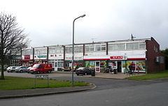 | ||
Uk snow storm slowmo snow 29 01 2015 inkersall chesterfield derbyshire
Inkersall and Inkersall Green are areas of settlement in Derbyshire, England. They are located south of the A619 road, 4 miles (6 km) east of Chesterfield.
Contents
- Uk snow storm slowmo snow 29 01 2015 inkersall chesterfield derbyshire
- Map of Inkersall Chesterfield UK
- Schools
- History
- References
Map of Inkersall, Chesterfield, UK
Inkersall is a small hamlet just outside Chesterfield, which has seen fast development over the last few years.
Schools
Located on the main road through Inkersall is the Infant and Primary School, which also includes a Nursery. This school has been located here for many years, and the Infant School playground has recently been improved and now has a host of different play areas.
Just down the road in Middlecroft is Springwell Community School, formally called Middlecroft School until it was merged with Hollingwood secondary school in 1991. Springwell caters for pupils of ages 11–16. This school is currently having a big improvement scheme, having just had a new drama department and new sports facilities added to the school.
History
The history of Inkersall was affected by nearby Rufford Abbey. The English Pope, Adrian IV, gave his blessing for the abbey in 1156 and following this the abbey's lands expanded and the villagers of Cratley, Rufford, Grimston and Inkersall were evicted.