
Existed: 1980 – present Constructed 1980 | Length 1,264 km | |
 | ||
Major cities | ||
A road trip on kohat indus highway
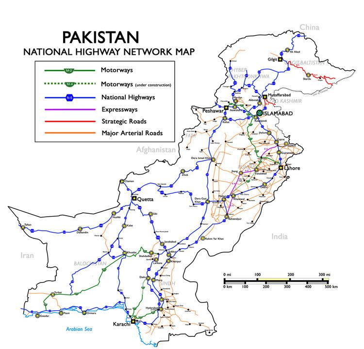
The Indus Highway (Urdu: شاہراہ سندھ), also known as National Highway 55 (N-55) (Urdu: قومی شاہراہ 55), is a 1264 km long four-lane national highway that runs along the Indus River in Pakistan connecting the port city of Karachi with the northwestern city of Peshawar via Dera Ghazi Khan. It is part of Pakistan's National Highways network and is maintained and operated by Pakistan's National Highway Authority. The Indus Highway passes through the Kohat Tunnel.From Dera Ghazi Khan To Rajanpur District there is a midpoint of both districts boundary which is separated by a Link road is known as "Basti Yaray Wali Ahmadani Sheru Raod".One main stop is knwon as "Zila Tax Ahmadani Chauk".Here Ahmadani Tribes are majority in strength.
Contents
Map of N-55, Pakistan
History
In 1980, the Indus Highway was proposed to provide an alternative and shorter route to the heavily used N-5 and to also aid the development of western Sindh province and eastern Khyber Pakhtunkhwa province. Construction began in 1981 from Karachi and was completed in 1985 in Peshawar.Major cities links Peshawar, Darra Adam Khel, Kohat, Karak, Lakki Marwat, Dera Ismail Khan, Dera Ghazi Khanra, Shikarpur, Sindh, Larkana, Kotri, Haidebad,