
Existed: 1932 – present South end: SR 352 Constructed 1932 | Length 60.32 km | |
 | ||
Counties | ||
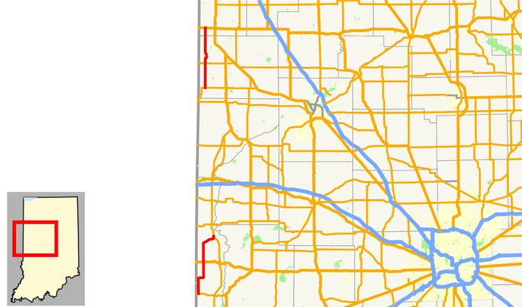
State Road 71 in west-central Indiana consists of two discontinuous north–south segments of two-lane rural roadway near the Illinois border.
Contents
Map of IN-71, Indiana, USA
Southern section
This section is about 20 miles (32 km) long and is entirely within Vermillion County. The southern terminus is at State Road 163 in the town of Blanford. The road passes north through the towns of West Clinton and St. Bernice. It crosses U.S. Route 36 just before passing through the town of Dana. It passes just to the west of the Newport Chemical Depot, then heads northeast to its northern terminus at State Road 63 northwest of Newport.
Northern section
This is a straight 17.5-mile (28.2 km) north–south road except for a small jog about halfway along its length. The southern terminus is at State Road 352 near Ambia. It passes through the small towns of Dunnington and Freeland Park, then crosses State Road 18. It passes through the town of Raub where it crosses the Kankakee, Beaverville and Southern Railroad on its way from Earl Park northwest through Sheldon, Illinois. The northern terminus at U.S. Route 24/U.S. Route 52 about two miles (3 km) directly west of Kentland. The highway is mostly within Benton County, but the northernmost portion, about two miles (3 km) long, is in Newton County.