
Counties: Harrison | Length 4.741 km | |
 | ||
North end: SR 62 in Harrison Township | ||
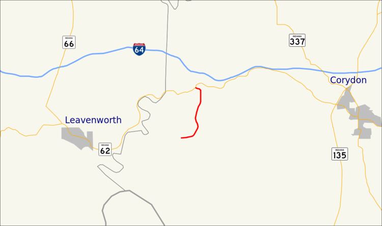
State Road 462 is a short three-mile (4.8 km) spur route in southwestern Harrison County, Indiana.
Contents
Map of IN-462, Corydon, IN 47112, USA
Route description
State Road 462 begins at State Road 62 and runs generally south through heavily wooded country. It crosses the Blue River just 0.02 miles (0.032 km) south of State Road 62 (which follows the line of the river here), and crosses Rock Creek after another 0.9 miles (1.4 km). It terminates at the O'Bannon Woods State Park and Cold Friday Road.
Major intersections
The entire route is in Harrison Township, Harrison County.
References
Indiana State Road 462 Wikipedia(Text) CC BY-SA