
Length 169.3 km | Constructed 1 October 1926 | |
 | ||
Existed: October 1, 1926 – present Counties | ||
State Road 16 is an east–west road in Northern Indiana. Its western terminus is at U.S. Route 41 in Ade, Indiana. Its eastern terminus is at State Road 5 north of Huntington, Indiana.
Contents
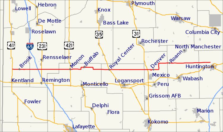
Map of IN-16, Indiana, USA
Route description
SR 16 begins at US 41 at a traffic light just east of Ade, then SR 16 heads due east toward Huntington. SR 16 passes through Brook and Monon where SR 16 meets U.S. Route 421. After Monon SR 16 passes through Buffalo, Royal Center, and Denver. After Denver SR 16 turns due north onto State Road 19, after 3 miles (4.8 km) SR 16 turns due east. Then SR 16 eastern terminus is at SR 5 north of Huntington.
History
Between 1917 and 1926, SR 16 was in southern Indiana going from Mt. Vernon to New Albany. Following the route that State Road 62 does today. Between 1926 and 1934 SR 16 went to the Ohio State Line. In 1934 U.S. Route 224 was commissioned in Indiana and was route onto SR 16 from Huntington to the Ohio State Line.