
Length 12.67 km | ||
 | ||
Counties | ||
State Road 130 in the U.S. state of Indiana is a short, 7.87-mile (12.67 km) road that connects Lake Station with Valparaiso to the southeast.
Contents
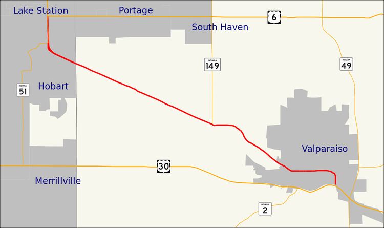
Map of IN-130, Indiana, USA
Route description
State Road 130 runs 7.9 miles (17.9 km) from State Road 149 near Valparaiso to U.S. Route 6 and State Road 51 in Hobart. This highway mainly follows a major rail line for its entire length. It formerly followed Lincoln Way (sometimes spelled "Lincolnway") for its entire length in Valparaiso, except south of LaPorte Avenue, where it was called Sturdy Road.
State Road 130 passes through the following cities, and intersects with highways at those locations:
State Road 130 is concurrent with SR 51 for one mile (1.6 km) south of its terminus on U.S. Route 6. State Road 51 then goes west into downtown Hobart, and State Road 130 goes southeast towards Porter County and Valparaiso.
State Road 130 can be considered a local spur of US 30. This differs from other highways, such as State Road 249, which exist outside of the grid system and are numbered according to the nearest grid number available.
History
State Road 130 south of LaPorte Avenue was at one point concurrent with State Road 2. When the Valparaiso Bypass (current State Road 49) was completed, State Road 49 was routed onto the bypass, and State Road 2 was routed with State Road 49 south to U.S. Route 30.
In 2015, State Road 130 was truncated at its intersection with State Road 149, and its remaining length was transferred to Porter County and Valparaiso.