
Country Algeria Elevation 1,026 m (3,366 ft) PMA seats (as of 2007) 7 Area 93,438 km² | Time zone CET (UTC+1) ONS code 1109 | |
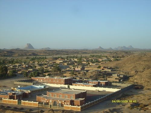 | ||
In Amguel (Arabic: عين امقل, lit. Amguel spring) is a town and commune in Tamanrasset District, Tamanrasset Province, Algeria. According to the 2008 census it has a population of 4,208, up from 3,030 in 1998, with an annual growth rate of 3.4%. Its postal code is 11100 and its municipal code is 1109.
Contents
Map of In Amguel, Algeria
Geography
In Amguel lies at an elevation of 981 metres (3,219 ft) on the southern bank of a wadi that cuts through a plateau lying to the northwest of the Hoggar Mountains. The numerous wadis in the area support some vegetation, but beyond them the land is barren and rocky.
Climate
In Amguel has a hot desert climate (Köppen climate classification BWh), with very hot summers and mild winters, and very little precipitation throughout the year.
Transportation
In Amguel is located on the N1 national highway, leading north to In Salah and south to Tamanrasset. Just to the south of the town, the N55 branches from the N1, leading to Bordj El Houasse.
Education
4.2% of the population has a tertiary education, and another 11.4% has completed secondary education. The overall literacy rate is 71.1%, and is 77.7% among males and 63.8% among females.
Localities
The commune is composed of eight localities: