
Country Algeria Elevation 293 m (961 ft) PMA seats (as of 2007) 11 Area 32,518 km² Local time Saturday 4:57 PM | Time zone CET (UTC+1) ONS code 1108 Population 32,518 (2008) Postal code 11220 Number of airports 1 | |
 | ||
Weather 31°C, Wind E at 23 km/h, 8% Humidity | ||
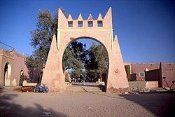
In Salah or Ain Salah (Arabic: عين صالح) is an oasis town in central Algeria. It was once an important trade link of the trans-Saharan caravan route. As of the 2008 census it has a population of 32,518, up from 28,022 in 1998, with an annual growth rate of 1.5%, the lowest in the province. The village is located in the heart of the Sahara Desert region of northern Africa. The name In Salah comes from the term "good well" although the water is known for its rather unpleasant, salty taste.
Contents
Map of Ain Salah, Algeria
Geography
A creeping sand dune on the western edge of town is advancing on the city and cuts In Salah in half. The dune is moving at a speed of approximately one meter (three feet) every five years. As buildings are covered by its leading edge, structures at the back of the dune are being gradually uncovered. When a formerly covered location at the back of the dune once again becomes free, it is established who the past owners were and the building is restored and moved into by relatives. Four red or violet clay brick ksour (walled villages) are found in the oasis, each having its own citadel.
Climate
In Salah has a hot desert climate (Köppen climate classification BWh), with long, hot summers and short, warm winters, and averages just 16 millimetres (0.63 in) of rainfall per year. Summer temperatures are consistently high as they commonly approach 50 °C (122 °F) but temperatures at night fall low enough to around 30 °C (86 °F). Even in early May or in late September, daytime temperatures can easily soar to 45 °C (113 °F). In Salah experiences the same kind of desert heat as Death Valley, California during summertime. Winter nights can be chilly and frost is by no means unknown but the days are pleasantly warm, sunny and dry. During the summer, the Sahara region of Algeria is the source of a scorching, sometimes dusty and southerly wind called the Sirocco. These winds parch the plateaus of northern Algeria up to 40 days and reach the Tell coastal region for as many as 20 days. In Salah has recorded at least 35 °C (95 °F) in every month of the year including January and December as the absolute records high temperatures are respectively 35 °C (95 °F) and 36 °C (96.8 °F) for these two months. The absolute records low temperatures are below the freezing point, with - 4 °C (24.8 °F) recorded in January and - 1 °C (30.2 °F) recorded in both February and December, although freezing temperatures are very rare and don't occur each year Average annual relative humidity is low with only 24%. The sky is clear all year and cloudy days are very rare. Thereby, the solar irradiation is among the highest found on the planet and the annual sunshine duration is estimated between 3,700 h and 4,000 h. In Salah is often quoted as one of the hottest spots worldwide. With Adrar and Reggane, In Salah forms the "Triangle of Fire" as local inhabitants say due to the extreme desert heat that bakes the region from May to September.