
River system Koshi River Mouth Dudh Kosi | Source Imja Glacier | |
 | ||
The Imja Khola (Nepali: इम्जा खोला) is a tributary of the Dudh Kosi in Nepal. It drains the slopes of Mount Everest. The Khumbu Glacier melts into the Lobujya (Lobuche) River, which flows southward as the Imja Khola to its confluence with the Dudh Kosi at Tengboche.
Contents
Map of Imja Khola, Khumjung, Nepal
The Imja Khola collects water from the Imja Glacier through the Dingboche Valley.
River course
The river rises in the lake Imja Tsho, which is mainly formed by the waters of the Imja Glacier, it flows in the direction southwest through the village of Dingboche, then it merges with the river Lobuche, which flows south, which is formed by the waters of the Khumbu Glacier. then flows southward to its confluence with the Dudh Kosi near the village of Tengboche
Trekking
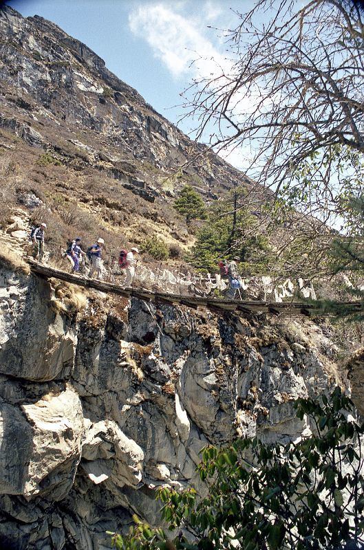
The Imja Khola is on the trekking route in the Everest base camp region, between Thyangboche and Dingboche at 4,360 metres (14,300 ft). There is a monastery at Pangboche at 3,900 metres (12,800 ft). The trek is through beautiful Rhododendron forest.
It is also on the trekking route to Chukhung and the Imja Tse or Island peak.
See also – video of bridge over Imja Khola
See also – pictures of a hike up the Imja Khola valley