
Local time Tuesday 4:31 AM | ||
 | ||
Weather -11°C, Wind W at 6 km/h, 83% Humidity | ||
Chukhung (Chukung) is a lodge village serving trekkers and climbers in the Khumbu Region of Nepal in the Himalayas south of Mount Everest.
Map of Chukhung 56000, Nepal
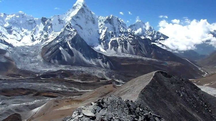
The Chukhung Valley lies on the southern slopes of Lhotse and Nuptse by the Lho Glacier and the Nup Glacier, the western slopes of Cho Polu and Baruntse by the Imja Glaciers, and the northern slopes of Mount Ama Dablam by the Ama Dablam Glacier and Chukhung Glacier. It extends westward past the village of Dingboche where it joins the Pheriche Valley. The Imja Khola flows through the Chukhung Valley.
Chukhung village, 4,730 metres (15,518 ft), is on a left fork of the Imja Khola. Administratively it is in the Rasuwa District of the Bagmati Zone. This area was traditionally used as a yak pasture with no permanent habitation. As Imja Tse has gained popularity as a trekking peak and the Chukhung Valley is a good acclimatization side trip for Everest Base Camp trekkers, several lodges have been built there.
Chukhung Ri is a rocky peak, similar to Kala Pattar, rising above the village of Chukhung to 5,550 metres (18,209 ft). It takes three hours or less to reach the summit from Chukhung and it requires no technical climbing. The summit has astounding views of Imja Tse (Island Peak), Ama Dablam, Makalu, and the Lhotse face, and it is a worthwhile addition to any climbing or trekking itinerary in the Khumbu region.