
Country United States Opened 1962 | Opening date 1962 Height 30 m Length 860 m Construction began June 1955 | |
 | ||
Spillway type Service, gate-controlled Owner United States Army Corps of Engineers Similar | ||
Tour the ice harbor dam
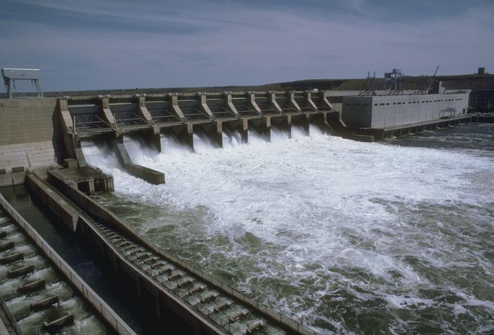
Ice Harbor Lock and Dam is a hydroelectric, concrete gravity run-of-the-river dam on the Snake River in Walla Walla and Franklin counties in the U.S. state of Washington. The dam is located 8 miles (13 km) northeast of the town of Burbank and 12 miles (19 km) east of Pasco, river mile 9.7. Its name comes from a tiny bay in the river where boats once tied up to wait for upstream ice-jams to break up.
Contents
- Tour the ice harbor dam
- Map of Ice Harbor Lock and Dam Burbank WA 99323 USA
- Tug hurricane departs ice harbor dam
- Dam systemEdit
- Visitor centerEdit
- Surrounding water bodiesEdit
- TemperatureEdit
- References
Map of Ice Harbor Lock and Dam, Burbank, WA 99323, USA
Construction began in June 1955. The main structure and three generators were completed in 1961, with an additional three generators finished in 1976. Generating capacity is 603 megawatts, with an overload capacity of 693 MW. The spillway has ten gates and is 590 feet (180 m) long.
Tug hurricane departs ice harbor dam
Dam systemEdit
Ice Harbor Dam is part of the Columbia River Basin system of dams.
Visitor centerEdit
Inside the Dam on the South side of the river is a large visitor center that has been recently updated to include a new film "The Snake - River of Life" and a new modern interactive touch screen kiosk with information on the dam and recreational opportunities in the area. The visitor center also has a fish ladder viewing room which offers an excellent view of migrating Salmon, Steelhead and Shad. Due to security, visitors must pass through the security gate to gain access.
Surrounding water bodiesEdit
Lake Sacajawea, named for Sacajawea, is formed behind the dam. The lake stretches to the base of Lower Monumental Dam, 32 miles (51 km) upstream. The Wallula Channel, formed from the backup of Snake River entering the Columbia River just southeast of Pasco, runs 10 miles (16 km) downstream from the base of the dam.
TemperatureEdit
The highest temperature ever measured in Washington state, at 118 °F (47.8 °C), was recorded at Ice Harbor Dam on August 5, 1961.