Rahul Sharma (Editor)

Hyōnosen Ushiroyama Nagisan Quasi National Park

Updated on
Edit
Like
Comment
Share on FacebookTweet on TwitterShare on LinkedInShare on Reddit
Location
  
Kansai Region, Japan

Nearest city
  
Toyooka

Area
  
488 km²

Established
  
April 10, 1969

Hyōnosen-Ushiroyama-Nagisan Quasi-National Park httpsuploadwikimediaorgwikipediacommonsthu

Governing body
  
Hyōgo Prefecture, Tottori Prefecture, Okayama Prefecture

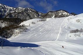
Hyōnosen-Ushiroyama-Nagisan Kokutei Kōen (氷ノ山後山那岐山国定公園) is a Quasi-National Park in Hyōgo Prefecture, Tottori Prefecture, and Okayama Prefecture, Japan. It was founded on 10 April 1969 and has an area of 488.03 square kilometres (188.43 sq mi).

Contents

Overview

Hyōnosen-Ushiroyama-Nagisan Kokutei Kōen comprises three areas of the Chūgoku Mountains, a mountain range which forms the backbone of the Chūgoku region of western Japan and extends under the Pacific Ocean. The park covers 48,803 hectares (120,590 acres): 25,200 hectares (62,000 acres) in Hyōgo Prefecture, 15,024 hectares (37,130 acres) in Okayama Prefecture, and 8,579 hectares (21,200 acres) in Tottori Prefecture.

Jurisdictions

  • Hyōgo Prefecture
  • Toyooka
  • Yabu
  • Shisō
  • Kami
  • Shin'onsen
  • Sayō
  • Okayama Prefecture
  • Mimasaka
  • Nishiawakura
  • Tottori Prefecture
  • City of Tottori
  • Iwami
  • Yazu
  • Wakasa
  • Chizu
  • Misasa
  • Mountains

    Important mountains of the park include:

  • Mount Hyōno -- 1,510 metres (4,950 ft). Hyōgo and Tottori prefectures
  • Mount Sobu -- 1,074 metres (3,524 ft). Hyōgo Prefecture
  • Mount Mimuro -- 1,358 metres (4,455 ft). Hyōgo and Tottori prefectures
  • Mount Ushiro -- 1,345 metres (4,413 ft). Hyōgo and Okayama prefectures
  • Mount Nagi -- 1,255 metres (4,117 ft). Tottori and Okayama prefectures
  • References

    Hyōnosen-Ushiroyama-Nagisan Quasi-National Park Wikipedia