
Constituency South Constituency Population 2,333 Website hveragerdi.is/English Local time Friday 12:29 PM | Manager Aldís Hafsteinsdóttir Municipal number 8716 Area 9 km² Postal code 810 | |
 | ||
Density 259.22/km (671.4/sq mi) Weather -2°C, Wind NE at 11 km/h, 64% Humidity | ||
Hverager i the amazing hot spring town in iceland
Hveragerði is a town and municipality in the south of Iceland located 45 km to the east of Reykjavík on Iceland's main ringroad, Route 1.
Contents
- Hverager i the amazing hot spring town in iceland
- Map of HveragerC3B0i Iceland
- Hverager i
- Overview
- References
Map of Hverager%C3%B0i, Iceland
The river Varmá runs through the town.
Hverager i
Overview
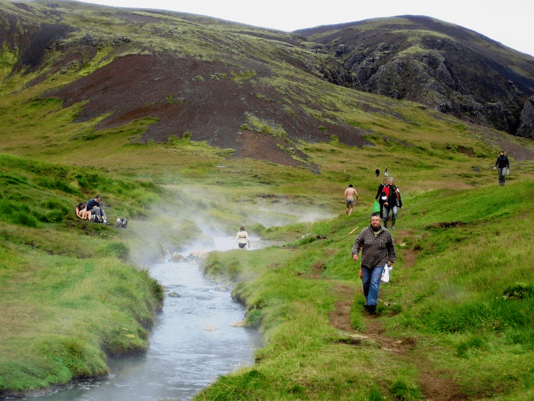
The surrounding area is part of the Hengill central volcano, and is geothermally active and experiences very frequent (usually minor) earthquakes. The town is known for its greenhouses, which are heated by hot water from volcanic hot springs. These springs are the site of occurrence of certain extremophile micro-organisms, that are capable of surviving in extremely hot environments. Close to the church is a hot spring called Sandhólshver, formed during the violent South Iceland earthquake of 1896. A fenced-off geothermal area in the town has numerous hot springs and fumaroles.
Hveragerði contains a number of greenhouses and is a hotbed for Icelandic horticulture.
To the south of Hveragerði, there is the small port of Þorlákshöfn, winter point of departure for the ferry to the Westman Islands.
The local football club is Hamar, who play in Iceland's third tier.