
Airport type Public Elevation AMSL 213 ft / 65 m 4,000 1,219 Code HSL Phone +1 907-829-2456 | 3/21 4,000 Address Huslia, AK 99746, USA Elevation 65 m | |
 | ||
Owner State of Alaska DOT&PF - Northern Region | ||
Huslia Airport (IATA: HSL, ICAO: PAHL, FAA LID: HLA) is a state-owned public-use airport located one nautical mile (1.85 km) east of the central business district of Huslia, in the Yukon-Koyukuk Census Area of the U.S. state of Alaska.
Contents
Although most U.S. airports use the same three-letter location identifier for the FAA and IATA, this airport is assigned HLA by the FAA and HSL by the IATA (which assigned HLA to Lanseria Airport in Lanseria, South Africa). The airport's ICAO identifier is PAHL.
Facilities
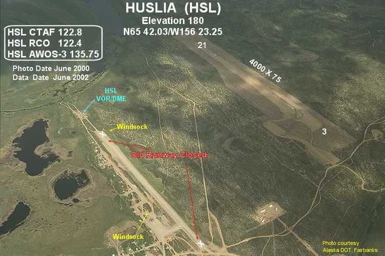
Huslia Airport covers an area of 203 acres (82 ha) at an elevation of 220 feet (67 m) above mean sea level. It has one runway designated 3/21 with a gravel surface measuring 4,000 by 75 feet (1,219 x 23 m). This replaced the former runway, which had the same designation and measured 3,000 by 60 feet (914 m × 18 m).
Airlines and destinations
The following airlines offer scheduled passenger service at this airport: