
Population 28,229 (2001) | Time zone IST (UTC+5:30) Local time Friday 8:30 AM | |
 | ||
Weather 26°C, Wind N at 8 km/h, 41% Humidity Neighborhoods Yalgud, Vishal Nagar, Mane Nagar, Rukmini Sase Nagar, Khemalapure Nagar, Rajguru Nagar, Bazaar Peth | ||
Hupari is a census town in Kolhapur district in the Indian state of Maharashtra. Hupari comes under Hatkanangle taluka.
Contents
Map of Hupari, Maharashtra
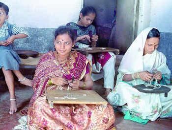
Hupari is famous for the production of silver ornaments. Most of the families in this village have ancestral skill for developing artistic ornaments from silver.
Demographics
As of 2001 India census, Hupari had a population of 28,229. Males constitute 51% of the population and females 49%. Hupari has an average literacy rate of 70%, higher than the national average of 59.5%: male literacy is 76%, and female literacy is 62%. In Hupari, 12% of the population is under 6 years of age.
References
Hupari Wikipedia(Text) CC BY-SA