
Airport type Public 12/30 3,600 Phone +1 479-738-7287 | Owner City of Huntsville Elevation AMSL 1,749 ft / 533 m 3,600 1,097 | |
 | ||
Address 800 Independence Ave, Huntsville, AR 72740, USA Similar United Country Scott Rea, Huntsville Police Departme, Huntsville Chamber of Comm, Huntsville High School, Fayetteville ‑ Drake Field | ||
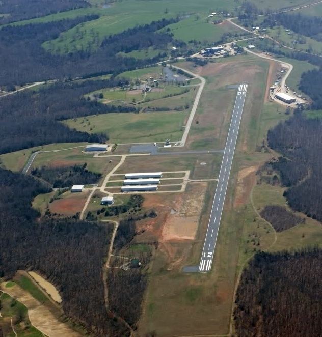
Huntsville Municipal Airport (FAA LID: H34) is a city owned, public-use airport located two nautical miles (2.3 mi, 3.7 km) southwest of the central business district of Huntsville, a city in Madison County, Arkansas, United States.
Facilities and aircraft
Huntsville Municipal Airport covers an area of 70 acres (28 ha) at an elevation of 1,749 feet (533 m) above mean sea level. It has two runways: 12/30 is 3,600 by 60 feet (1,097 x 18 m) with an asphalt pavement and 3/21 is 1,250 by 60 feet (381 x 18 m) with a turf surface.
For the 12-month period ending November 30, 2010, the airport had 5,000 aircraft operations, an average of 13 per day: 96% general aviation and 4% military. At that time there were 27 aircraft based at this airport: 85% single-engine, 4% multi-engine, and 11% ultralight.