
Country United States FIPS code 05-33970 Elevation 463 m Zip code 72740 Local time Thursday 9:27 PM | Time zone Central (CST) (UTC-6) GNIS feature ID 0077258 Area 7.8 km² Population 2,381 (2013) Area code 479 | |
 | ||
Weather 10°C, Wind S at 19 km/h, 78% Humidity | ||
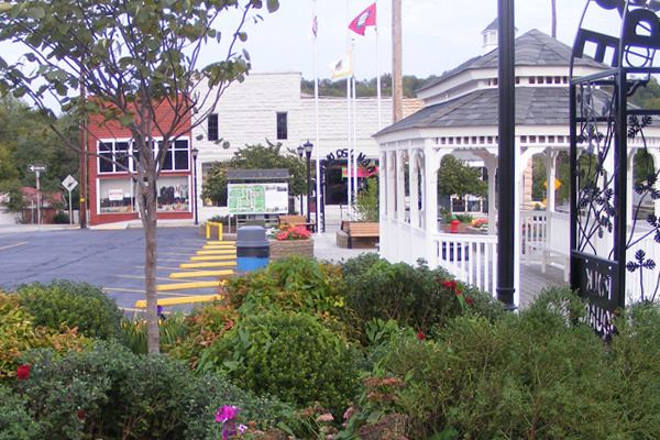
Trying to speak out in huntsville arkansas
Huntsville is a city in mountainous Madison County, Arkansas, United States. The population was 2,346 at the 2010 census. The city is the county seat of Madison County. During the American Civil War it was the site of what became known as the Huntsville Massacre.
Contents
- Trying to speak out in huntsville arkansas
- Map of Huntsville AR 72740 USA
- History
- Geography
- Demographics
- Transportation
- Notable people
- References
Map of Huntsville, AR 72740, USA
Huntsville is part of the Fayetteville–Springdale–Rogers, AR-MO Metropolitan Statistical Area.
History
Huntsville was named for John Hunt, the founder of Huntsville, Alabama. The community was incorporated on July 16, 1925.
Geography
Huntsville is located at 36°5′23″N 93°44′6″W (36.089672, -93.735101).
According to the United States Census Bureau, the city has a total area of 3.0 square miles (7.8 km2), all land.
Demographics
As of the census of 2000, there were 1,931 people, 761 households, and 493 families residing in the city. The population density was 640.0 people per square mile (246.9/km²). There were 853 housing units at an average density of 282.7/sq mi (109.1/km²). The racial makeup of the city was 90.21% White, 0.10% Black or African American, 2.12% Native American, 0.21% Pacific Islander, 6.53% from other races, and 0.83% from two or more races. 12.79% of the population were Hispanic or Latino of any race.
There were 761 households out of which 33.5% had children under the age of 18 living with them, 45.2% were married couples living together, 15.8% had a female householder with no husband present, and 35.1% were non-families. 32.5% of all households were made up of individuals and 20.0% had someone living alone who was 65 years of age or older. The average household size was 2.43 and the average family size was 3.03.
In the city, the population was spread out with 26.8% under the age of 18, 10.2% from 18 to 24, 22.5% from 25 to 44, 18.8% from 45 to 64, and 21.8% who were 65 years of age or older. The median age was 36 years. For every 100 females there were 87.8 males. For every 100 females age 18 and over, there were 82.0 males.
The median income for a household in the city was $25,288, and the median income for a family was $32,609. Males had a median income of $26,929 versus $19,766 for females. The per capita income for the city was $14,686. About 20.9% of families and 23.7% of the population were below the poverty line, including 32.4% of those under age 18 and 26.8% of those age 65 or over.
Transportation
The Huntsville Municipal Airport is a city owned, public-use airport located two nautical miles (4 km) southwest of Huntsville's central business district.