
OS grid reference SP950382 Post town MILTON KEYNES Dialling code 01908 | Sovereign state United Kingdom Postcode district MK17 | |
 | ||
Hulcote is a small village located in the Central Bedfordshire district of Bedfordshire, England.
Map of Hulcote, Milton Keynes, UK
Historically part of the Manshead hundred, some evidence has been found indicating possible Neolithic, New Stone Age and Roman settlement in the area. However, it is known that Hulcote has been consistently occupied since the Dark Ages.
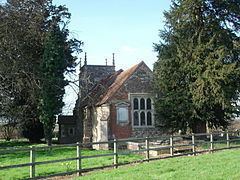
The ecclesiastical parishes of Hulcote and Salford were united in 1750. The Hulcote and Salford (where the 2011 population was included) civil parish was formed in 1933.
Today, Hulcote is located directly to the north of the M1 motorway, close to the border of the Milton Keynes Borough in Buckinghamshire.
References
Hulcote, Bedfordshire Wikipedia(Text) CC BY-SA