
Length 29 km | - elevation 1,074 ft (327 m) - elevation 1,098 ft (335 m) - elevation 614 ft (187 m) | |
 | ||
Source Ritchie County, West Virginia | ||
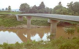
The Hughes River is a tributary of the Little Kanawha River in western West Virginia in the United States. Via the Little Kanawha and Ohio Rivers, it is part of the watershed of the Mississippi River. As measured from the confluence of its north and south forks, the Hughes is 18 mi (29 km) long, and drains a rural area of the unglaciated portion of the Allegheny Plateau.
Contents
Map of Hughes River, West Virginia, USA
The river is believed to have been discovered and named by the 18th-century settler Jesse Hughes, but it may also have been named for others of the same surname residing in the area during roughly the same time period. According to the Geographic Names Information System, it has also been known historically as the Junius River.
CourseEdit
The Hughes flows for most of its length through Ritchie County as two streams:
The Hughes' north and south forks join near the community of Cisco, and the Hughes River then flows for 18 mi (29 km) through northern Wirt County and meets the Little Kanawha River near the community of Newark, 12 mi (19 km) southeast of Parkersburg.
Varieties of fish in the Hughes River include muskellunge; rock, smallmouth and spotted bass; flathead and channel catfish; and several species of sunfish.