
Country United States FIPS code 54-12124 Elevation 199 m Population 273 (2013) Area code 304 | Time zone Eastern (EST) (UTC-5) GNIS feature ID 1536852 Zip code 26337 Local time Monday 1:57 AM | |
 | ||
Weather 5°C, Wind S at 8 km/h, 58% Humidity Area 124 ha (122 ha Land / 3 ha Water) | ||
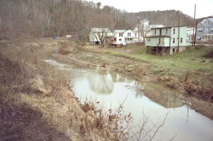
Cairo /ˈkɛəroʊ/ CARE-o is a town in Ritchie County, West Virginia, United States, along West Virginia Route 31, the North Fork of the Hughes River, and the North Bend Rail Trail. The population was 281 at the 2010 census.
Contents
Map of Cairo, WV 26337, USA
History
The town was named by its earliest settlers, who were Scots Presbyterians, for the city of Cairo, Egypt, owing to the presence of water and fertile land at the site. Cairo was incorporated in 1895. The North Bend Rail Trail passes through the town.
The former Bank of Cairo building, now Cairo Town Hall, was listed on the National Register of Historic Places in 1996.
Geography
Cairo is located at 39°12′30″N 81°9′24″W (39.208264, -81.156600).
According to the United States Census Bureau, the town has a total area of 0.48 square miles (1.24 km2), of which, 0.47 square miles (1.22 km2) is land and 0.01 square miles (0.03 km2) is water.
2010 census
As of the census of 2010, there were 281 people, 118 households, and 71 families residing in the town. The population density was 597.9 inhabitants per square mile (230.9/km2). There were 151 housing units at an average density of 321.3 per square mile (124.1/km2). The racial makeup of the town was 100.0% White.
There were 118 households of which 28.8% had children under the age of 18 living with them, 49.2% were married couples living together, 6.8% had a female householder with no husband present, 4.2% had a male householder with no wife present, and 39.8% were non-families. 36.4% of all households were made up of individuals and 12.7% had someone living alone who was 65 years of age or older. The average household size was 2.38 and the average family size was 3.13.
The median age in the town was 40.6 years. 23.5% of residents were under the age of 18; 10.6% were between the ages of 18 and 24; 20.3% were from 25 to 44; 30.9% were from 45 to 64; and 14.6% were 65 years of age or older. The gender makeup of the town was 52.0% male and 48.0% female.
2000 census
As of the census of 2000, there were 263 people, 112 households, and 73 families residing in the town. The population density was 536.2 inhabitants per square mile (207.2/km²). There were 140 housing units at an average density of 285.4 per square mile (110.3/km²). The racial makeup of the town was 100.00% White.
There were 112 households out of which 29.5% had children under the age of 18 living with them, 52.7% were married couples living together, 11.6% had a female householder with no husband present, and 34.8% were non-families. 30.4% of all households were made up of individuals and 10.7% had someone living alone who was 65 years of age or older. The average household size was 2.35 and the average family size was 3.00.
In the town, the population was spread out with 25.1% under the age of 18, 6.8% from 18 to 24, 27.8% from 25 to 44, 27.0% from 45 to 64, and 13.3% who were 65 years of age or older. The median age was 41 years. For every 100 females there were 85.2 males. For every 100 females age 18 and over, there were 89.4 males.
The median income for a household in the town was $24,688, and the median income for a family was $29,792. Males had a median income of $20,833 versus $21,750 for females. The per capita income for the town was $14,958. About 9.5% of families and 14.0% of the population were below the poverty line, including 19.7% of those under the age of eighteen and 4.3% of those sixty five or over.
Climate
The climate in this area is characterized by hot, humid summers and generally mild to cool winters. According to the Köppen Climate Classification system, Cairo has a humid subtropical climate, abbreviated "Cfa" on climate maps.