
Visitors 17 million (in 2015) Hiking trails 4 miles (6.4 km) Opened 23 July 1998 | Status Open Area 223 ha | |
Type Urban parkRiverfront parkEstuarine sanctuary Operated by State of New YorkCity of New YorkHudson River Park Trust Similar | ||
Secret central park hudson river park
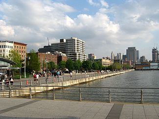
Hudson River Park is a waterside park on the North River (Hudson River), and is the part of the Manhattan Waterfront Greenway that extends from 59th Street south to Battery Park in the New York City borough of Manhattan. It is a joint state and city collaboration. It is a 550-acre (2.2 km2) park stretching 4.5 miles (7.2 km), making it the second-biggest park in Manhattan after Central Park. The park arose as part of the West Side Highway replacement project in the wake of the abandoned Westway plan.
Contents
- Secret central park hudson river park
- Hudson river park a new york treasure
- Land use
- Conception and construction
- 2010s
- Recreation
- Structures
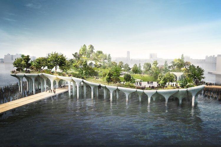
- Notable piers
- References
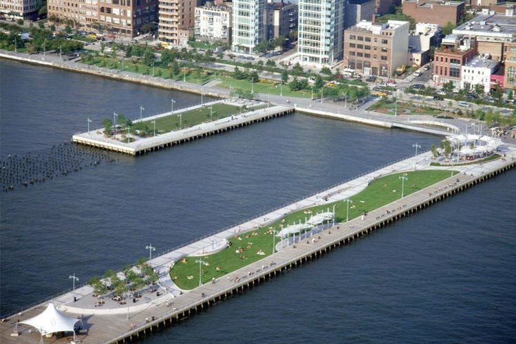
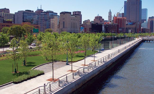
Bicycle and pedestrian paths, spanning the park north to south, open up the waterfront for recreational use. The park includes tennis and soccer fields, batting cages, children's playground, dog run, and many other features. The parkland also incorporates several rebuilt North River piers along its length, formerly used for shipping.
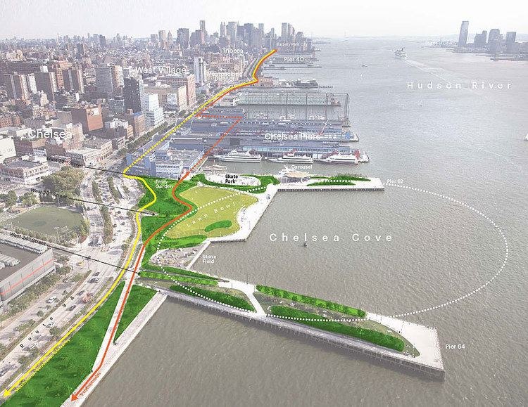
Hudson River Park connects many other recreational sites and landmarks. It runs through the Manhattan neighborhoods of Lower Manhattan (including Battery Park City, World Trade Center, and Tribeca), Greenwich Village (including the West Village and Meatpacking District), Chelsea, and Midtown West (which includes Hudson Yards and Hell's Kitchen/Clinton).
Hudson river park a new york treasure
Land use
Prior to American colonization of New Netherland, Native Americans lived on the shore of the southernmost portion of the Hudson River—where the park now is—seasonally, in a place called "Sapohanikan". It was near the present-day intersection of Gansevoort Street and Washington Street. It was probably a hunting and fishing site, and Native Americans probably used the oyster reefs on the shore as well; after European settlement, the Europeans began using these reefs.
Later, oyster barges, which sold high volumes of oysters, opened along the Hudson River shore, within several North River piers. Because of their quantity, they were often sold at cheap prices, and immigrants to New York City often relied on eating oysters. These oyster barges closed when the oysters died due to overfarming and to pollution resulting from the shore's industrialization.
In 1807, the first steamboat in passenger operation, Clermont, was launched from present-day Pier 45, in the West Village. The Clermont, the first successful boat of its kind in the United States, helped give Robert Fulton control over all steamboat operations on the rest of the Hudson River. The English White Star Line, consisting of the Lusitania, the Olympic, and the Titanic, had a terminal at Pier 54. It was at this location where survivors of the sinking of the Titanic arrived in the Carpathia.
By the late 19th century, the Slaughterhouse District was created along the Hudson River shoreline in present-day Hell's Kitchen. A stretch of 39th Street between 11th and 12th Avenues was called Abattoir Place until the early 20th century. In the 1870s, tunnels to herd cattle under 12th Avenue were created at 34th and 38th Streets. The cattle industry in this area continued through the 1960s.
Conception and construction
What is now Hudson River Park emerged from the failed 1970s and 1980s Westway proposal to replace the dilapidated West Side Highway with an interstate highway connecting the Brooklyn-Battery Tunnel ( then I-278), the Holland Tunnel (I-78), and the Lincoln Tunnel ( I-495). The right-of-way of the new six-lane highway would have demolished the then-existing West Side piers and replaced them with 220 acres (89 ha) of landfill, through which the new highway would have tunneled. In addition to 100 acres (40 ha) of development, the plan also had provisions for 98 acres (40 ha) of continuous parkland to be laid on top of the highway, including four waterside parks and a three-mile-long (4.8 km) tree-lined promenade and bike path on the waterfront. Around 90% of the funds for the project were to come from federal aid. The project was abandoned on September 19, 1985 due to political as well as environmental objections, particularly concerns over spending in Congress as well as concerns over the Hudson River striped bass habitat by the courts. Much of the estimated $2 billion in federal funds allocated for the Westway was diverted to mass transit.
A new plan for development was announced in 1992 by then-Governor Mario Cuomo and then-Mayor David Dinkins, targeting the Jacob Javits Center, Chelsea Piers, and Pier 40 as key locations for commercial development. The 1992 memorandum also created the Hudson River Park Corporation, later renamed the Hudson River Park Conservancy, as a government agency constituted of members appointed by the governor and mayor. Construction of the Chelsea Piers complex began in July 1994, opening in stages beginning in May 1995. The development plan for the rest of the park was signed in September 1998 by Governor George Pataki, dividing ownership of the land between New York State (the southern half, from Battery Park to 35th Street) and the City (the northern half, from 35th Street to 59th). Both halves were leased to the joint entity now known as the Hudson River Park Trust. The plan also guaranteed that half of several locations, including Piers 40, 76, and 84, would be reserved for parkland. The park was initially expected to be completed by 2003, with construction costs estimated at around $300 million. The first complete section of the park opened in 2003 in Greenwich Village.
2010s
After two decades of planning and construction, much of the park remains incomplete. Half of the park was complete by 2009, and as of 2015 70 percent of the park has been finished, at a cost of nearly $500 million.
Parts of the Hudson River Park remained without power in the months after Hurricane Sandy in October 2012, due to damaged electrical cables. As a result, the Hudson River Park temporarily limited hours after nightfall in the park. Before Hurricane Sandy, the park's paths alongside the river remained open until 1 am EDT. After Hurricane Sandy, the park worked to return to normal operating hours once they restored power to affected areas. Full power was restored in June 2014, 20 months after the storm, with total damages accumulating to $32 million.
By June 2013, the Hudson River Park trust was in debt. A bill passed in June 2013 ended maintenance of a section of the park in Battery Park City, as well as the purchase of liability insurance, which would give $750,000 in savings to the park. However, the park was to run a $8.5 million deficit for fiscal year 2014. To further ameliorate the debt, the bill provided for the trust to make passengers pay to board sightseeing cruise ships in the park. Finally, the bill allowed the park to sell air rights across the street from the park, specifically St. John's Terminal across from Pier 40. In addition, Pier 40, which would have garnered large profits for the park, would cost more than $100 million to renovate.
Recreation
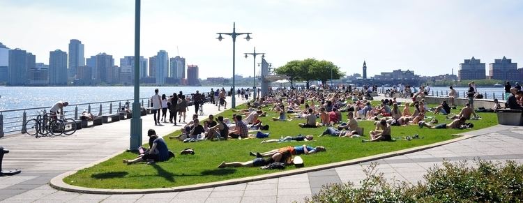
Recreational facilities of many kinds are located throughout Hudson River Park, catering to organized and individual sports, leisure activities, and activities for children. A defining physical feature of Hudson River Park is the five-mile (8.0 km) bike and running path that runs the park's length, connecting northward to Riverside South north of 59th Street and southward to Battery Park. Constructed by the State Department of Transportation, it is "the busiest bikeway in America" according to the Park Trust.
Scattered throughout the park are numerous fields and courts, with Chelsea Waterside Park (bounded by 24th Street, 11th Avenue, and 12th Avenue) being one center of sports activity. The park contains a sports field, a basketball court, a playground with water features during the summer months, and a dog run named "Best of New York" by New York Magazine in May 2005. Pier 84 at West 44th Street is also packed with activities. Free fishing with Big City Fishing is available on the pier as well as free rowing and boat building at the Village Community Boathouse on the south side of Pier 40. Other maritime related activities include outrigger rowing and kayaking at Pier 26. The Water taxi stops at Pier 42 near Christopher St. Also on the pier are a dog run and playground, and the casual restaurant PD O'Hurleys. Other sporting facilities include basketball courts at Canal Street and at Harrison Street, tennis courts south of Pier 40 between Houston and Canal Streets, beach volleyball, and a California-style skate park at West 30th Street.
The largest sporting complex in Hudson River Park is the Chelsea Piers Sports and Entertainment Complex, which holds a variety of athletic spaces. Chelsea Piers sports a batting cage, bowling lanes, playing fields, a driving range, an ice skating rink, rock climbing facilities, and gymnastics space, among other exercise and fitness related spaces. Along with these indoor recreational facilities, Chelsea Piers offers boating activities and several restaurants on premises.
Hudson River Park offers opportunities for outrigger canoeing on Pier 66 at West 26th Street, rowing and sailing on Piers 40 and 66, and free kayaking on Piers 96, 84, 66, and 40. The free kayaking attraction, run by New York City-based nonprofit organizations and volunteers, allows visitors to kayak along the Hudson River. The kayaking attraction, which are open five days a week including Saturdays and Sundays, serve as an affordable activity for tourists and resident New Yorkers alike, provided that the kayakers sign waivers and wear life vests.
Abundant open grassy areas in the park permit non-athletic leisure activity. Suntanning is a popular pastime in many areas. Clinton Cove (55th Street), Pier 84 (44th Street), the 14th Street Park, and Pier 45 are all wide unobstructed green spaces for sunbathing, and are popular locations.
Structures
Points of interest along the park's route include: