
UBIGEO 0201 | Region Ancash Elevation 3,052 m (10,013 ft) Website www.munihuaraz.gob.pe | |
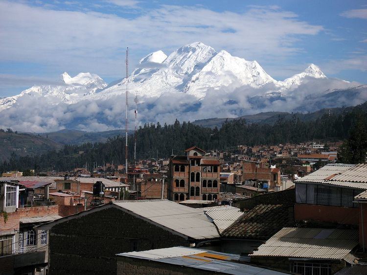 | ||
The Huaraz Province is one of twenty provinces of the Ancash Region in Peru. It was created on August 5, 1857 during the presidency of Ramón Castilla. Geographically, the province is located over the Callejón de Huaylas and the western slopes of the Cordillera Negra.
Contents
Map of Huaraz, Peru
The Regional Museum of Archaeology – known as the biggest lithic museum in South America - is located here. Some other highlights of the province are the Pumacayán hill, the hot springs of Monterrey (at 6 km or 4 mi from the city) and the Willkawayin ruins, at 13 kilometres (8 mi) to the north of Huaraz, in Paria. There is also a Museum of Miniatures, that is the only one in South America.
Geography
The Cordillera Blanca and the Cordillera Negra traverse the province. Some of the highest peaks of the province are Pucaranra, Chinchey, Tocllaraju and Huantsán. Other mountains are listed below:
At 30 kilometres (20 mi) from Huaraz, by the route Huaraz–Casma that crosses the Cordillera Negra, there is a place named Punta Callan in the summit of this mountain range. It offers a panoramic sight of the Cordillera Blanca and the Callejón de Huaylas.
Political division
Huaraz is divided into twelve districts, which are the following:
Ethnic groups
The province is inhabited by indigenous citizens of Quechua descent. Spanish is the language which the majority of the population (63.43%) learnt to speak in childhood, 36.28% of the residents started speaking using the Quechua language (2007 Peru Census).