
Country District Huamachuco | Region La Libertad | |
 | ||
Map of Huamachuco
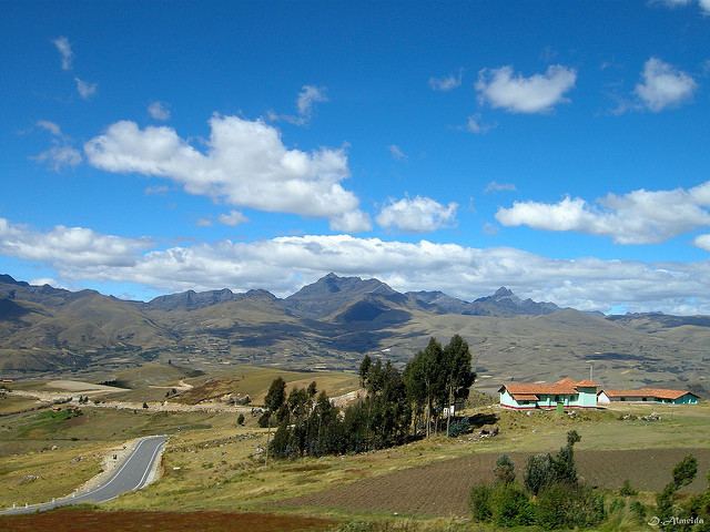
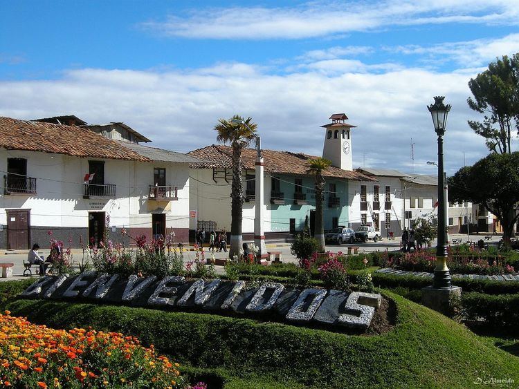
Huamachuco is a town in northern Peru and capital of the province Sánchez Carrión in La Libertad Region. The city is the seat of the Territorial Prelature of Huamachuco. Lake Sausacocha lies to the northeast.
Contents
- Map of Huamachuco
- Peruvian highlands vicos and huamachuco adventures
- Reportaje al peru tv peru huamachuco la sierra la libertad 24 05 2015
- Settlements
- Geography
- Banks
- References

About 30 miles away, within the Huamachuco district, is the significant archeological site of Marcahuamachuco. It is a complex of monuments, a prehistoric political and religious center of a culture that thrived 350 CE-1100 CE.
Peruvian highlands vicos and huamachuco adventures
Reportaje al peru tv peru huamachuco la sierra la libertad 24 05 2015
Settlements
During the Andean formative and Developmental period, small settlements grew up throughout the highlands of the Huamachuco area. The Huari people built dwellings that were simple oval-shaped single rooms made of field stones, with floors of clay. These structures were used in the agricultural communities mainly for storage of crops and other goods, and sleeping.
The hamlets at higher elevations (3900–4000 m.) were bases for their herding of domesticated animals, as agriculture could not survive at those heights. The settlements in the lower elevations (2500–3000 m.) contained large amounts of agricultural tools, showing the importance of crops.
The large center of Marcahuamachuco, about 30 miles away, has monumental remains that constitute an archeological site. Researchers believe that it served as a political and religious center for the elites of the society.
The prehistoric Huari economy in the area depended on both agriculture and domesticated livestock, with additional hunting of game. The people ran animal herds of domesticated llama and alpaca in the higher elevations, and cultivated crops at lower elevations.
In the puna grasslands, the people cultivated domesticated tubers such as potatoes, oca, isanu, ulluca, maca, and arachacha. They also had crops of seed-producing plants, such as varieties of chenopods and lupines, and also amaranths, legumes, cucurbits, and beans. Agriculture was based primarily on potatoes, oca, isanu, ulluca, maca, and arachacha. Throughout this period, the people also developed and maintained intricate networks of irrigated terraces to support maize crops.
In addition to using their domesticated animals for food, the people of Huamachuco hunted game, such as deer and birds. They also hunted various types of rodents. The peoples depended on their domestic animals to satisfy much of their need for food, clothing, and transportation. They used them less in agriculture.
Metal artifacts have been found, attesting to their skilled artisans. Their materials were not only gold, silver, and copper, but also gilded copper and some arsenic bronze mixtures. Common metal products included chisels, adzes, plates, pins, tupus, needles, and tweezers; ingots and scraps of pure metals have been recovered as archeological artifacts.
Textile manufacture was an essential prehistoric economic activity in this region, as evidenced by the many weaving tools found at the archeological site. Due to the wet climate, virtually no ancient textiles from this area have survived.
There is evidence that Huamachuco had trade and other interaction with neighboring areas, including Cajamarca to the south, and the Recuay and Moche cultures to the west. Through Callejon de Huaylas, it also traded with the coast. With its political center Marcahuamachuco, the people of Huamachuco traded during the Andean regional period.
By the late nineteenth century, there was international interest in the region. European travelers had published drawings and reports of the Marcahuamachuco ruins. Political unrest and an outbreak of fighting was reported by The New York Times of the United States in August 1883.
Geography
Huamachuco is located between the eastern and western cordillera of the Andes Mountains, and 100 km south of Cajamarca.
It has highland areas that range from 2500–4500 m. above sea level. Because of the heights, most of Huamachuco's land is treeless. The high-altitude grassland is known as puna. The highland is bounded on the east and west by two parallel sierra ranges. The puna grasslands were ideal habitats for deer and wild camelids. They also supported the domesticated camelids: alpacas and llamas.
Huamachuco's deep valley slopes show evidence of deliberate farming of native Andean trees and shrub vegetation. It appears that in prehistoric times, the temperature of the land was slightly warmer than today, allowing agriculture at elevations 100–300 m. higher than is possible in the 20th and 21st centuries.