
Postcode(s) 7018 | LGA(s) City of Clarence Postal code 7018 | |
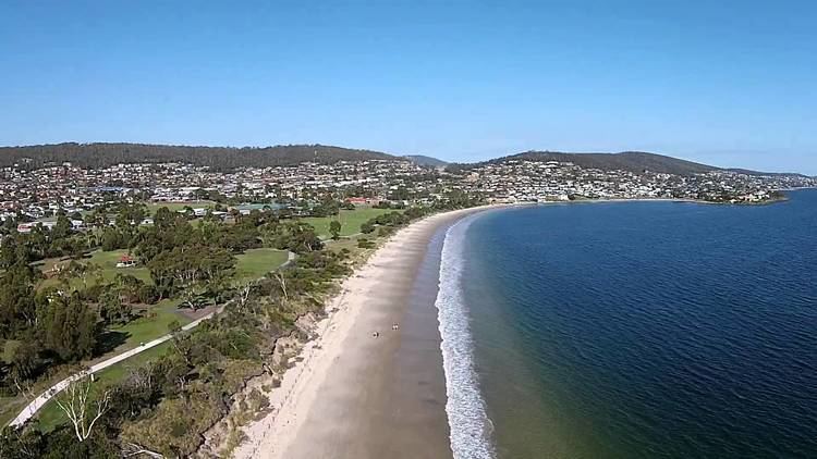 | ||
Howrah is a suburb of the City of Clarence, part of the greater Hobart area, Tasmania, Australia. It is east of Bellerive and north of Tranmere.
Map of Howrah TAS 7018, Australia
Howrah is a beachside suburb, with views across the Derwent River to Hobart City. Clarence Street runs through the centre of the suburb separating the hillside section from the beachside.
Howrah has a number of parks including Wentworth Park, which is one of the key sport (such as soccer, field hockey and touch football) and recreation areas on the Eastern Shore.
Clarence High School is generally thought to be in Howrah, due to it being located west of Wentworth Street, however it is in Bellerive. Howrah has a primary school, Howrah Primary.
Shoreline Shopping Centre, is the largest shopping centre in Howrah.
Howrah was named after Howrah House, a property established in the 1830s on Clarence Plains by a retired Indian Army officer who took the name from a place of the same name near Calcutta.