
Location New York | Length 3.219 km | |
 | ||
Postal code 10002, 10009, 10012, 10014 Similar Mercury Lounge, Orchard Street, Grand Street, Little Italy, Bleecker Street/Broadway–Lafayette Street | ||
Houston streets
Houston Street (/ˈhaʊstən/ HOW-stən) is a major east-west thoroughfare in downtown Manhattan, running crosstown across the full width of the island of Manhattan, from Franklin D. Roosevelt East River Drive (FDR Drive) and East River Park on the East River to Pier 40 and West Street on the Hudson River. It generally serves as the boundary between neighborhoods, with Alphabet City, the East Village, NoHo, Greenwich Village, and the West Village lying to the north of the street, and the Lower East Side, most of the Bowery, Nolita, and SoHo to the south. The numeric street-naming grid in Manhattan, created as part of the Commissioners' Plan of 1811, begins immediately north of Houston Street with 1st Street at Avenue A, although the grid does not fully come into effect until 13th Street.
Contents
- Houston streets
- Map of E Houston St New York NY USA
- The big o the brick ballades houston street
- Description
- History
- Transportation
- References
Map of E Houston St, New York, NY, USA
The street's name is pronounced "HOW-stən", unlike the city of Houston in Texas, which is pronounced "HYOO-stən". This is because the street was named for William Houstoun, whereas the city was named for Sam Houston.
The big o the brick ballades houston street
Description
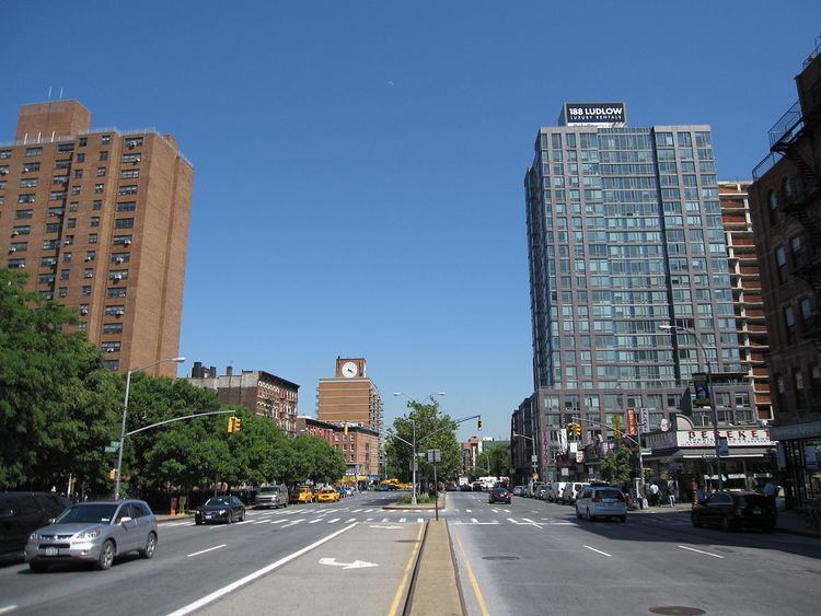
At its east end, Houston Street meets FDR Drive in an interchange at East River Park. West of FDR Drive it intersects with Avenue D. Further west, other streets, including First Avenue, the Bowery, Lafayette Street and Broadway, intersect Houston Street. The Broadway intersection is the division point between East Houston Street and West Houston Street. Sixth Avenue intersects Houston Street at a curve in the road in Greenwich Village. East of Sixth Avenue, Houston street is bidirectional and separated by a median; west of Sixth, the street is narrower and unidirectional westbound. West Houston Street terminates at an intersection with West Street near Pier 40 on the Hudson River.
History
Houston Street is named for William Houstoun, who was a delegate from State of Georgia to the Continental Congress from 1784 through 1786 and to the Constitutional Convention in 1787. The street was christened by Nicholas Bayard III, whose daughter, Mary, was married to Houstoun in 1788. The couple met while Houstoun, a member of an ancient and aristocratic Scottish family, was serving in the Congress. Bayard cut the street through a tract he owned in the vicinity of Canal Street in which he lived, and the city later extended it to include North Street, the northern border of New York's east side at the beginning of the 19th century.
The current spelling of the name is a corruption: the street appears as Houstoun in the city's Common Council minutes for 1808 and the official map drawn in 1811 to establish the street grid that is still current. In those years, the Texas hero Sam Houston, for whom the street is sometimes incorrectly said to have been named, was an unknown teenager in Tennessee. Also mistaken is the explanation that the name derives from the Dutch words huis for house and tuin for garden. The narrow, westernmost stretch of the current Houston Street, from Sixth Avenue to the West Side Highway, was known as "Hammersley Street" (also spelled "Hamersly Street") until the middle 19th century, and was inside Greenwich Village. It later came to be regarded as the Village's southern boundary.
In 1891, Nikola Tesla established his Houston Street laboratory. Much of Tesla's research was lost in an 1895 fire.
The street, originally narrow, was markedly widened from Sixth Avenue to Essex Street in the early 1930s during construction of the Independent Subway System's Sixth Avenue Line. The street widening involved demolition of buildings on both sides of the street, resulting in numerous small, empty lots. Although some of these lots have been redeveloped, many of them are now used by vendors, and some have been turned into playgrounds and, more recently, community gardens.
Lower Manhattan's SoHo district takes its name from an acronym for "South of Houston", as the street serves as SoHo's northern boundary; another, narrower neighborhood north of Houston Street is correspondingly called NoHo.
A reconstruction project has been rebuilding parts of the street since 2005; it is nearly complete as of 2014.
Transportation
As of 2010, Houston Street is served by the M21 New York City Bus route from the FDR Drive to Washington Street. The bus route itself had replaced an earlier streetcar line, which is now the M9 from Avenues A to C.
A portion of the New York City Subway's IND Sixth Avenue Line runs under Houston Street, between Sixth Avenue to just before Avenue A; there are stations at Second Avenue (F train) and Broadway – Lafayette Street (B D F M trains). Additionally, there is a station at Seventh Avenue, for the Houston Street (1 2 trains). The Bleecker Street station (4 6 <6> trains) has station entrances on the north side of Houston Street, due to its connection with the Broadway – Lafayette Street station as part of a larger station complex.
Exit 5 on the FDR Drive is on Houston Street. The street also connects directly with West Street and the West Side Highway; however, by then, Houston Street is westbound-only.