
OS grid reference TQ970450 Sovereign state United Kingdom Local time Wednesday 7:18 AM | Civil parish Hothfield Area 9.59 km² Dialling code 01233 | |
 | ||
Population 780 (Civil Parish 2011) Weather 8°C, Wind NW at 5 km/h, 97% Humidity | ||
Hothfield is a village and civil parish in the Ashford Borough of Kent, England and is 3 miles north-west of Ashford on the A20. It is completely split in two by Hothfield Common.
Contents
Map of Hothfield, Ashford, UK
Geography
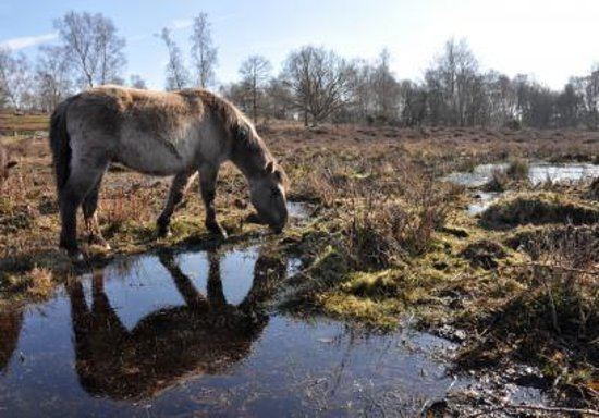
In the north west is Hothfield Common, 58 hectares (143 acres) of heathland and lowland valley bogs: a nature reserve managed by Kent Wildlife Trust,
To the immediate south is the private parkland of the former Hothfield House. This area is crossed by the Greensand Way passing the church en route to Godinton House. A small part of the neighbourhood of Ram Lane is in the far northern point of the civil parish. Small tributaries of the West Stour rise in the parish.
Amenities
The village has a shop and post office with internal ATM service (closed Tuesday PM and Sunday PM). Hothfield Common has a children's playground and a multi-use all-weather games pitch adjacent to the south east and a car park to the north just off the A20.
History
The medieval parish church is dedicated to Saint Margaret; it was rebuilt in 1598 after a fire.
Hothfield in Edward Hasted's Topography of Kent (1798) has a substantial amount of information about the history and the then layout of land and settlement.
Transport
The village is immediately for approximately one mile on the south-east of the A20 road and is south of the M20 which has a very small border to the far north. It was served by Hothfield railway station on the Maidstone Line from 1884 to 1959.