
Isolation 3.46 mi (5.57 km) Easiest route Scramble Prominence 175 m | Elevation 2,213 m | |
 | ||
Topo map USGS 7.5' topographic mapHorsetooth Reservoir, Colorado Similar Front Range, Grays Peak, Torreys Peak, Greyrock Mountain, Longs Peak | ||
Horsetooth mountain and falls fort collins colorado
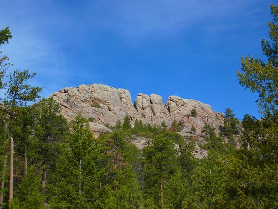
Horsetooth Mountain is a mountain summit in the foothills of the Front Range of the Rocky Mountains of North America. The 7,259-foot (2,213 m) peak is located in the Horsetooth Mountain Open Space, 7.0 miles (11.2 km) west (bearing 265°) of downtown Fort Collins in Larimer County, Colorado, United States.
Contents
- Horsetooth mountain and falls fort collins colorado
- Map of Horsetooth Mountain Colorado 80538 USA
- Horsetooth mountain in a colorado minute week 180 hd
- Mountain
- References
Map of Horsetooth Mountain, Colorado 80538, USA
Horsetooth mountain in a colorado minute week 180 hd
Mountain
The mountain is easily distinguishable by the large rock formation on its summit known as Horsetooth Rock. The formation is a prominent landmark of the nearby city of Fort Collins and often used as a symbol of that city, appearing in the official city seal. The name comes from its distinctive appearance.
The rock was previously on the private property of the Soderburg family. In 1982, it was purchased by the county as an "open space" tax acquisition. It is now a popular destination for hikers as well as mountain bikers, with trails leading to the summit. The summit offers hikers a clear view to the southwest of Longs Peak and Mount Meeker, two rugged mountains in Rocky Mountain National Park.