
Isolation 0.73 mi (1.17 km) Prominence 131 m | Elevation 4,240 m | |
 | ||
Topo map USGS 7.5' topographic mapAllenspark, Colorado Similar Longs Peak, Mount Alice, Mount Lady Washington, Twin Sisters Peaks, Front Range | ||
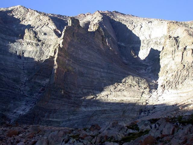
Mount Meeker is a high mountain summit of the Twin Peaks Massif in the northern Front Range of the Rocky Mountains of North America. The 13,916-foot (4,242 m) thirteener is located in the Rocky Mountain National Park Wilderness, 4.8 miles (7.7 km) west by north (bearing 285°) of the community of Allenspark in Boulder County, Colorado, United States.
Contents
Map of Mt Meeker, Colorado 80510, USA
MountainEdit
Mount Meeker is the second highest summit in Rocky Mountain National Park after its neighbor Longs Peak, 0.7 miles (1.1 km) to the northwest. Due to its location southeast of Longs Peak, Mount Meeker is more visually prominent along much of the northern Front Range Urban Corridor. The peak is considered more difficult to climb, technically, than Longs Peak on certain routes.
Historical namesEdit
A couple of French trappers called Longs Peak and Mount Meeker Les Deux Oreilles (French for "two ears") in 1799. The name Mount Meeker was first suggested in 1873 when the Hayden Survey was performed. Present were William Byers, Anna Dickinson, and Ralph Meeker, the son of Nathan Meeker. It was officially named Mount Meeker in 1911.