
Electoral ward Northern | North Takapu Valley | |
 | ||
West Grenada North, Woodridge, Newlands | ||
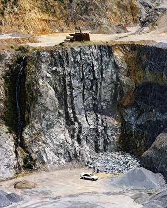
Horokiwi is an outer suburb of Wellington. The area is semi-rural and there are no schools; most children attend schools in nearby Newlands. The only feature other than houses and farms is Horokiwi Quarry.
Contents
Map of Horokiwi, Wellington, New Zealand
Access and roads
The only access to Horokiwi is via Horokiwi Road, a road that climbs up a hill and branches off the Petone-Wellington motorway. There are only five steets/roads; Horokiwi Road, Hillcroft Road, Lincolnshire Road, Woollaston Way and Van Der Velden Way. The former runs for approximately 6.5km, and the final kilometer eventually reaches Belmont Regional Park and becomes much more narrow. It also provides scenic views of Lower Hutt, Wellington Harbour, and other northern suburbs of Wellington such as Tawa and Grenada North.
In 2010, Horokiwi Road closed for about two months, causing long detours for residents.