
Settled 1544 Time zone EEST (UTC+3) Area 22.1 km² Local time Tuesday 10:03 PM | State Mahiloŭ Elevation 191 m (627 ft) Postal code 213410 Population 32,777 (2009) | |
 | ||
Weather 2°C, Wind SE at 3 km/h, 70% Humidity | ||
Horki (Belarusian: Горкі, [ˈɣorkʲi]) is a town in the Mogilev Region of Belarus, an administrative center of the Horki Raion. As of 2009, its population was 32,777.
Contents
Map of Horki, Belarus
History
For the first time Horki was mentioned in written sources ("The Lithuanian Chronicles") in 1544 as a village. First known owner was prince Drutski-Gorski. Since 1584 Horki was owned by Sapegas. In the 17th century the village became the center for Gory-Horki estate. Until the 19th century it was called Gory-Horki called. Trades fairs were regularly held in Horki. In 1683 there were 510 houses and 2 service land holdings: “Kazimirovskaya Slaboda” and “Zarechye.” There were 3 markets, where trading merchants from Belarus and Russia were offering their goods.
During the Northern War between Russia and Sweden Tsar Peter I stayed in Horki. (from July 9 to August 16, 1708.) The first section of the “Rech Pospolitaya” is an important historical milestone in the existence of Horki and Horki District. Decree of the Ruling Senate on October 23, 1772 Mogilev Province was divided into four provinces - Mogilev, Mstislav, Rogachev and Orsha. Horki and surrounding areas were included in the Orsha province, and from 1777 - in Orsha district, and then Kopyssky district.
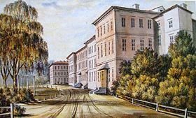
In 1840 was opened Horki Agricultural School. In 1848 Horki Agricultural School was transformed into Horki Agricultural Institute. From this time Horki became the center of agricultural education in Belarus. Opening of agricultural institutions contributed to the economic development of the Horki. Thus, in 1859 began working iron foundry, opened a post office (1840), pharmacy (1840), the meteorological station (1841).
On December 26, 1861 Tsarist government ordered to change status of village to status of town.
State peasants, who lived in Horki, had the right to remain in the same class or go to the category of lower middle class. At the same time they would depart their land to the Ministry of State Property. For the conduct of municipal services and judicial affairs was created Horki City Council. The following year, in the Horki from Kopyss were transferred the court, district treasury, post office, city hospital, military command and other institutions. In August 1867 had approved the provision of arms of the city Horki: "... to portray in this coat of arms, as the main emblem of the city Horki, three hills, the middle higher than others, and to indicate the occupation of farming population of the city – wheat plants growing out of the tips of the hills, in the top part of the coat of arms to put Mogilev province coat of arms and decorate the tower with three prongs."
Coat of Gorki and Gorki district is part of the historical and heraldic monuments of Belarus. The flag is based on the stamp image. The artist was V. A. Lyahor.
Current emblem and flag of the city approved by Presidential Decree 24 August 2006 № 526 "On establishing the official heraldic symbols of administrative and territorial units of Mogilev region."