
Primary outflows Hopfensee Ach Max. length 2,145 m (7,037 ft) Surface elevation 784 m Shore length 6.8 km Mean depth 4.6 m | Max. width 1.48 km (0.92 mi) Area 194 ha Length 2.145 km Width 1.48 km | |
 | ||
Primary inflows Similar Forggensee, Weißensee (Füssen), Alatsee, Alps, Bannwaldsee | ||
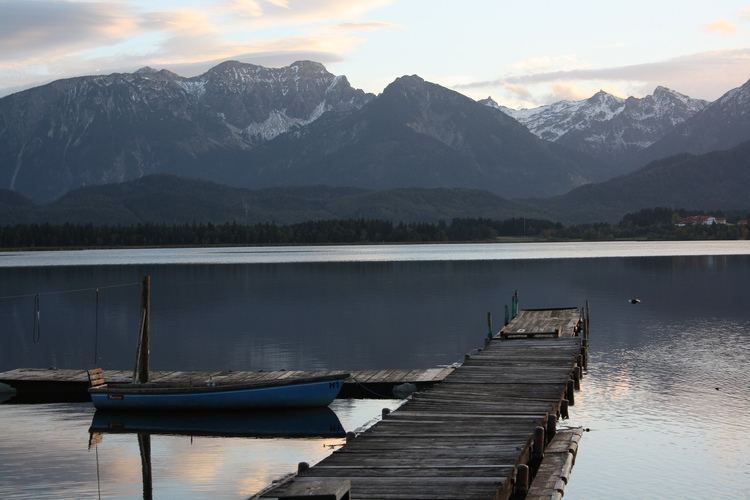
Hopfensee is a lake in Bayerisch Schwaben, Bavaria, Germany. At an elevation of 783.8 m, its surface area is 194 ha.
Map of Hopfensee, 87629 F%C3%BCssen, Germany
The maximum length of the lake is 2.1 km, and its circumference is 6.8 km. It lies north of Füssen in Ostallgäu. Its maximum depth is 10 m. It was formed by the Lechtal glacier and is one of the remains of a larger Fuessener See. The Hopfensee-Ach flows out of the lake and into the Forggensee.
On the northeast shore is the resort Hopfen am See. There is a campground on the east shore. Besides swimming, which is possible as early as the end of May, boating, sailing, and wind surfing are popular activities.
The north shore has a spectacular view of the Allgäu Alps.
References
Hopfensee Wikipedia(Text) CC BY-SA