
Nearest city Kailua Kona, Hawaii Architectural style Dry stack masonry Area 4.698 km² Established November 10, 1978 Management National Park Service | Architect Unknown Visitation 153,584 (2012) Phone +1 808-329-6881 Added to NRHP 10 November 1978 | |
 | ||
Location Hawaii County, Hawaii, United States Website Kaloko-Honokōhau National Historical Park Address Kailua-Kona, HI 96740, USA Hours Open today · 8:30AM–4PMTuesday8:30AM–4PMWednesday8:30AM–4PMThursday8:30AM–4PMFriday8:30AM–4PMSaturday8:30AM–4PMSunday8:30AM–4PMMonday8:30AM–4PM Similar Hulihee Palace, Manini'owali Beach, Mauna Kea Summit Adventures, Puʻuhonua o Hōnauna, Puʻukoholā Heiau National Profiles | ||
Honok hau settlement and kaloko honok hau national historical park
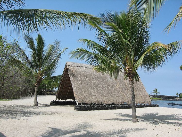
Kaloko-Honokōhau National Historical Park is a United States National Historical Park located in the Kona District on the Big island of Hawaiʻi in the U.S. state of Hawaiʻi. It includes the National Historic Landmarked archaeological site known as the Honokōhau Settlement. The park was established on November 10, 1978, for the preservation, protection and interpretation of traditional native Hawaiian activities and culture.
Contents
- Honok hau settlement and kaloko honok hau national historical park
- HistoryEdit
- KalokoEdit
- HonokhauEdit
- RecreationEdit
- References
HistoryEdit
Kaloko and Honokōhau are the names of two of the four different ahupuaʻa, or traditional mountain-to-sea land divisions encompassed by the park. Although in ancient times this arid area of lava rock was called kekaha ʻaʻole wai (lands without water), the abundant sea life attracted settlement for hundreds of years.
KalokoEdit
Kaloko (meaning "the pond" in the Hawaiian language) is a site of fishponds used in ancient Hawaii is on the North end of the park. The first reference to the pond comes from the story of Kamalalawalu, about 300 years ago. The kuapā (seawall) is over 30 feet wide and 6 feet high, stretching for 750 feet. Constructed by hand without mortar, the angle and gaps between the stones deflected the surf better than many modern concrete seawalls.
ʻAimakapā fishpond is an important wetland area protecting native birds including the koloa maoli (Hawaiian duck, Anas wyvilliana), ʻalae keʻokeʻo (Hawaiian coot, Fulica alai), āeʻo (Hawaiian stilt, Himantopus mexicanus knudseni), auʻkuʻu (black-crowned night heron, Nycticorax nycticorax), among others. The area is currently under reforestation, after the removal of non-native invasive plants. It was added to the Register of Historic Places in 1978 as site 78003148.
HonokōhauEdit
Honokōhau means "bay drawing dew" and refers to the ancient settlement on the south part of the park. This area can be reached via trails from the park visitor's center, or from the small boat harbor access road on Kealakehe Parkway. Features include loko iʻa (Ancient Hawaiian aquaculture fishponds), kahua (house site platforms), kiʻi pōhaku (petroglyphs), hōlua (stone slides) and heiau (religious sites). The ʻAiʻopio Fishtrap is a 1.7-acre (0.69 ha) pond, with a stone wall forming an artificial enclosure along the naturally curved shoreline of a bay. Small openings allowed young fish to enter from the sea, but as they grew larger (or at low tide) they were easily caught with nets inside the trap as needed. It was added to the National Register of Historic Places in 1966 as site 66000287.
RecreationEdit
Several restored trails include about one mile of the Māmalahoa Trail. It was built in the mid-19th century, and evolved over the years into the Hawaii Belt Road which encircles the entire island. The coastal trail is part of the Ala Kahakai National Historic Trail. The Honokōhau boat harbor provides a launching area for traditional canoes, fishing boats, Scuba diving and snorkeling tours of the area.