
Population 6,919 (2011 census) Civil parish Holybrook Area 194 ha | OS grid reference SU6671 | |
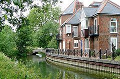 | ||
Holybrook is a civil parish, the only such area forming a contiguous part of Reading in West Berkshire and is a mixture of urban, suburban land with watercourses and flood meadows in Berkshire, England. The parish takes its name from the Holy Brook, a watercourse which forms its southern boundary and which is a corollary of the River Kennet. Its main settlements are part of Calcot those commonly known as Beansheaf Farm and Fords Farm, Holybrook and occasionally considered part of Calcot or Southcote which overlaps with this area.
Contents
Map of Holybrook, UK
Geography and history
Historically, since before the Norman Conquest this was part of the parish of Reading, when its Southcot or Southcote part was a well-dispersed settlement. Holybrook is definitively made up of two suburbs of Reading: Beansheaf Farm and Fords Farm, together with that part of the older suburb of Calcot that lies south of the A4 Bath Road. The church of St Michael, Reading that is in this area was built in 1967, one of only a small minority built to serve a new parish in that decade.
The civil parish dates from 2000 when it was created from the part of Theale east of the M4 motorway.
Governance
The parish has an elected parish council, and falls within the area of the unitary authority of West Berkshire. The parish council and the unitary authority are responsible for different aspects of local government. The parish is in Reading West parliamentary constituency.