
Listing Ultra Elevation 2,995 m Prominence 2,136 m | Mountain type Limestone First ascent 1832 First ascender Peter Gappmayr | |
 | ||
Pronunciation German: [ˌhoː.ɐˈdaxʃtaɪn] Similar Grossglockner, Großvenediger, Hochkönig, Grimming, 5 Fingers | ||
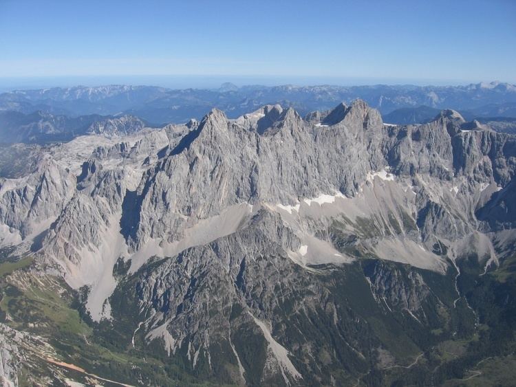
Hoher Dachstein is a strongly karstic Austrian mountain, and the second highest mountain in the Northern Limestone Alps. It is situated at the border of Upper Austria and Styria in central Austria, and is the highest point in each of those states. Parts of the massif also lie in the state of Salzburg, leading to the mountain being referred to as the Drei-Länder-Berg ("three-state mountain"). The Dachstein massif covers an area of around 20×30 km with dozens of peaks above 2,500 m, the highest of which are in the southern and south-western areas. Seen from the north, the Dachstein massif is dominated by the glaciers with the rocky summits rising beyond them. By contrast, to the south, the mountain drops almost vertically to the valley floor.
Contents
Map of Hoher Dachstein, 4830, Austria
Geology
The geology of the Dachstein massif is dominated by the so-called Dachstein-Kalk ("Dachstein limestone"), dating from Triassic times. In common with other karstic areas, the Dachstein is permeated by a rich cave system, including some of the largest caves in Austria, such as the Mammuthhöhle and the Hirlatzhöhle. Another significant tourist destination is the Eisriesenhöhle. The Dachstein is famous for its fossils, including Megalodonts; the Linzer Weg leads over many such fossils, which are referred to as Kuhtritte ("cattle footprints").
Glaciers are uncommon in the Northern Limestone Alps, and those on the Dachstein — the Hallstätter Gletscher ("Hallstatt glacier"), the Großer Gosaugletscher ("great Gosau glacier") and the Schladminger Gletscher ("Schladming glacier") — are the largest, as well as being the northernmost and the easternmost in the whole of the Alps. Several smaller ice-fields also exist, such as the Kleine Gosaugletscher ("lesser Gosau glacier") and the Schneelochgletscher ("snow-hole glacier"). The glaciers are retreating rapidly, and may disappear entirely within 80 years. The Hallstatt glacier withdrew by 20 m in the year 2003 alone.
Climbing
The summit was first reached in 1832 by Peter Gappmayr, via the Gosau glacier, after an earlier attempt by Erzherzog Karl via the Hallstätter glacier had failed. Within two years of Gappmayr's success a wooden cross had been erected at the summit. The first person to reach the summit in winter was Friedrich Simony, on 14 January 1847. The sheer southern face was first climbed on 22 September 1909 by the brothers Irg and Franz Steiner.
Being the highest point of two different Bundesländer, the summit is a popular goal in both summer and winter. In fine weather as many as 100 climbers may be attempting the ascent, leading to congestion at key sections of the climb.
Routes
The best-known routes are
These routes require basic alpine equipment for crossing the glaciers and knowledge of climbing. The more interesting climbing routes are concentrated on the south face, the most famous among them being the Steinerweg (graded V) and the Pichlweg (graded IV).