Area 18.91 km² | Elevation 747 m | |
 | ||
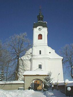
Hladovka (Polish: Głodówka) is a village and municipality in Tvrdošín District in the Žilina Region of northern Slovakia.
Contents
Map of 027 13 Hladovka, Slovakia
History
In historical records the village was first mentioned in 1598. Until 1918/20 it belonged to Hungary, 1920-1924 and 1938-1939 to Poland, 1939-1945 to Slovakia, 1945-1993 to Czechoslovakia.
Geography
The municipality lies at an altitude of 747 metres and covers an area of 18.098 km². It has a population of about 960 people.
References
Hladovka Wikipedia(Text) CC BY-SA
